Earth Science and Climatology 2017
Shortlisted entries in the Earth Science and Climatology category from the 2017 Royal Society Publishing Photography Competition.
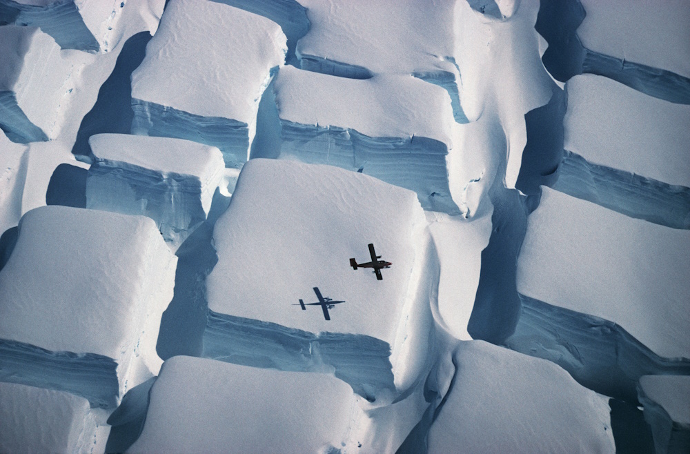
Overall winner "Icy sugar cubes." by Peter Convey. The scale of Antarctica is awesome but hard to grasp. This photo, taken in early 1995 during a flight over the English Coast (southern Antarctic Peninsula) at about 74 degrees south, illustrates the scale of unusual bi-directional crevassing as an ice sheet is stretched in two directions over an underlying rise, with a Twin Otter aeroplane as scale. The photo was taken with a Pentax ME Super camera and 70-300 mm zoom on Kodachrome 64 slide film, with no technical details recorded, and has been scanned at the British Antarctic Survey.
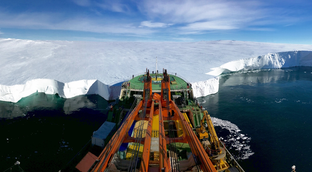
Runner up "Bow first." by Giuseppe Suaria. The Russian research vessel Akademik Tryoshnikov leans the bow against the Mertz Glacier's snout in Eastern Antarctica. The photo was taken moments before deploying ROPOS, a Remotely Operated Underwater Vehicle (ROV) under the glacier tongue to investigate the melting of the ice-sheet after a piece of ice protruding 100 kilometres (62 miles) out into the Southern Ocean broke away from the main body of the tongue in 2010. These scientific investigations were taken during the Antarctic Circumnavigation Expedition, an unprecedented three-month expedition organized by the Swiss Polar Institute, aimed to gain a better understanding of Antarctica and of the Southern Ocean as a whole. 22 scientific projects and more than 150 researchers were present onboard, covering a wide range of fields, including glaciology, climatology, biology and oceanography. Minor contrast and tone regulations were applied in post-processing.
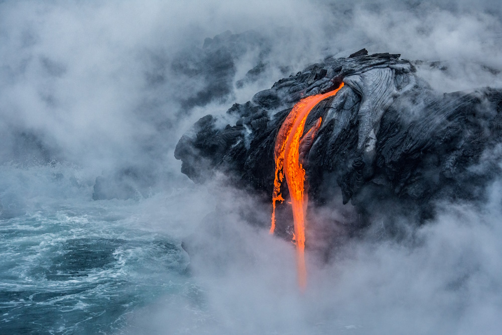
Honourable mention "Pele's fire." by Sabrina Koehler. I had the unique opportunity this year to capture nature's creation, the 61G lava flow at the current Pu'u O'o eruption site of the active Kilauea volcano in Hawaii's Volcano National Park. Hawai'i, or the Big Island, is the last of a series of islands created by this volcano, and still growing landmass every year. I went there by boat since it's the way to go if you want to get very close. It was stunning. I had my 55-300 mm Tele lens and didn't even need the full extend to capture the image. That's how close we were.
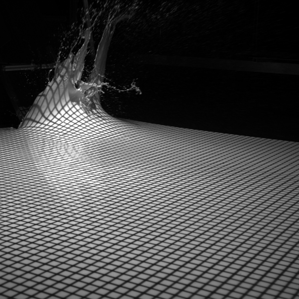
Shortlisted "Rising wave." by Frederic Evers. Landslides may generate tsunami-like waves when they impact the sea or a lake. Retreating glaciers and melting permafrost are among the main drivers for these events as they involve the formation of instable slopes. The photo shows a wave basin experiment at ETH Zurich right after slide impact at the water surface. White-coloured water in combination with a grid projection allows for tracking the generated wave heights with multiple cameras. Such experiments help to improve the prediction of future events. The shot was taken out of an image series captured at a frame rate of 50 Hz with a pco.edge 3.1 camera featuring a greyscale sensor and a Zeiss Distagon T 2/28 lens. The image was cropped to a quadratic shape.
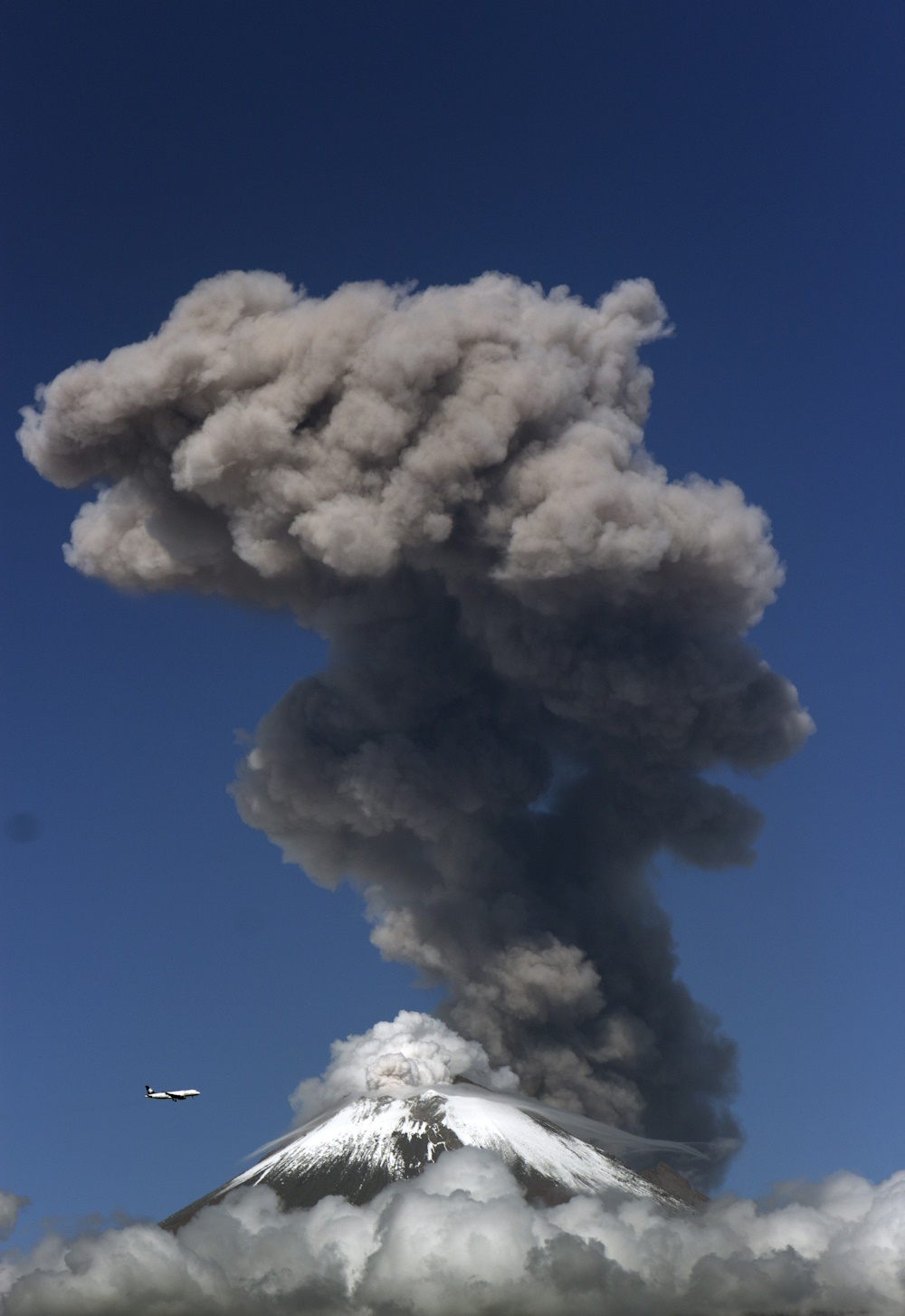
Shortlisted "Popocatepetl 2017." by Daniel Cruz Juárez. In this photograph I wanted to show the dimension that has a volcanic eruption in relation to an airplane, that although they are not in the same position, the proportions are incredible. The date on which this event occurred was Monday 21 August, hours before the great eclipse. It could be thought that there is a direct relationship between the events, I consider that it was only a coincidence. A beautiful coincidence. For several years the Popocatepetl volcano in Mexico has been in a period of activity, it is one of the most observed volcanoes in the world and in the place where I live (Cholula, Puebla, Mexico) we have the great privilege to have it close and to have these images. F: 6.3 Speed: 1 / 400s ISO: 100 Focal Length: 135mm RAW With only contrast and tone adjustments in Photoshop.
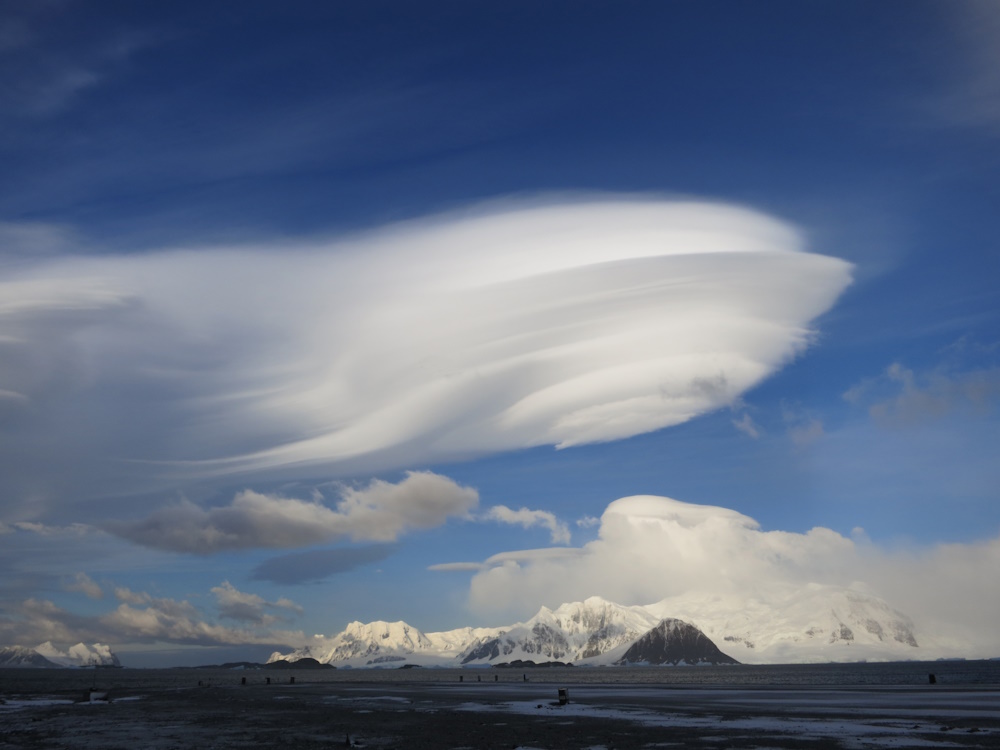
Shortlisted "Lenticular forcing." by Gail Ashton. Mount Liotard forces spaceship-like lenticular clouds on the horizon over Adelaide Island in the Antarctic. The phenomenon provides infomation about the local weather conditions at the British Antarctic Survey's Rothera Research Station. Canon PowerShot S100, with minor detailing in Photoshop.
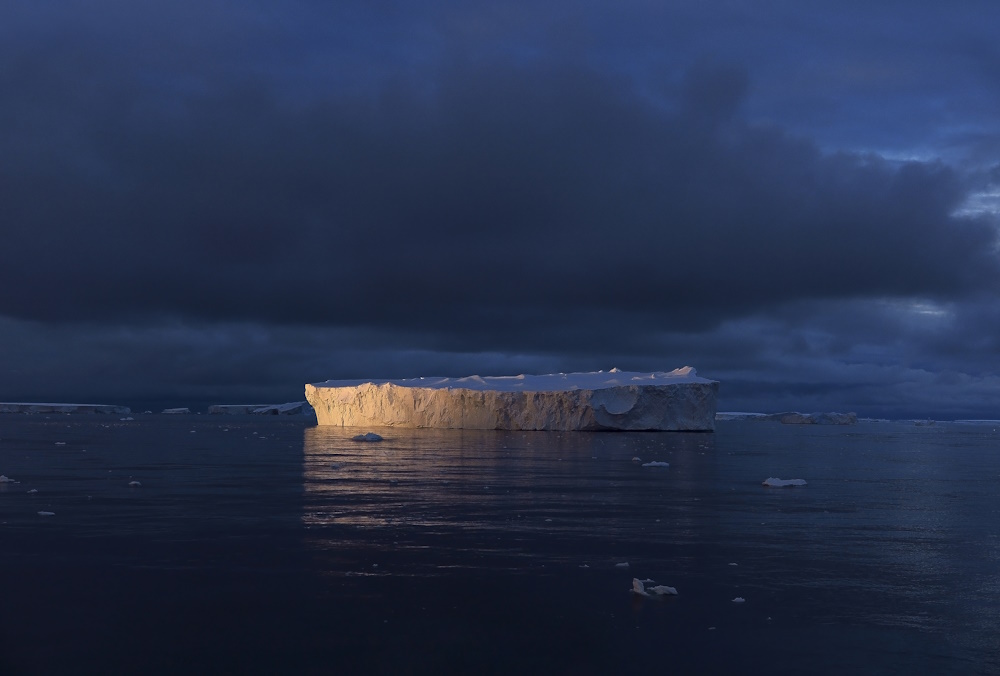
Shortlisted "Ice rays." by Giuseppe Suaria. An iceberg reflects the last sun rays of a polar evening in the Mount Siple region, a 3110 metre active unclimbed volcano that dominates the northwestern part of Siple Island in Western Antarctica. This region, which is normally inaccessible and completely covered in ice during the austral summer, was found free of ice and was visited in February 2017 by the members of the 'Antarctic Circumnavigation Expedition', an unprecedented three-months scientific expedition organized by the Swiss Polar Institute, aimed to gain a better understanding of Antarctica and of the Southern Ocean as a whole. 22 scientific projects and more than 150 researchers were present onboard, covering a wide range of fields, including glaciology, climatology, biology and oceanography. Minor contrast and tone regulations were applied in post-processing.

