Links to external sources may no longer work as intended. The content may not represent the latest thinking in this area or the Society’s current position on the topic.
The terrestrial laser scanning revolution in forest ecology
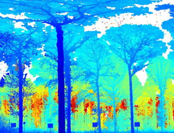
Theo Murphy Scientific meeting organised by Professor Mark Danson, Dr Mat Disney, Dr Rachel Gaulton and Professor Crystal Schaaf.
New laser scanning technologies are set to revolutionise the way in which we map and monitor changes in ecosystem structure and function. This meeting will provide an interdisciplinary focus to explore developments in terrestrial laser scanning (TLS) to measure forest carbon dynamics, vegetation phenology and habitat structure, all urgently required to better understand and predict changes in forest ecosystems.
The schedule of talks and speaker biographies are available below. Recorded audio of the presentations will be available on this page after the meeting has taken place. Meeting papers will be published in a future version of Interface Focus.
Attending this event
This is a residential conference, which allows for increased discussion and networking. It is free to attend, however participants need to cover their accommodation and catering costs if required.
For any enquiries please contact the Scientific Programmes team.
Organisers
Schedule
Chair
Dr Rachel Gaulton, University of Newcastle, UK

Dr Rachel Gaulton, University of Newcastle, UK
Rachel Gaulton has been a Lecturer in Remote Sensing at Newcastle University since 2011. With a background in ecology, her research interests lie in the application of remote sensing techniques to ecological and environmental monitoring, with a particular focus on the measurement of vegetation structure, dynamics and health. Current research, examining tree and crop health, aims to advance the measurement of vegetation biochemistry, through the use of imaging, field spectroscopy and terrestrial laser scanning approaches, including the application of ‘next-generation’ dual-wavelength laser scanners. Wider research interests are focussed on the role of ground-based and near ground sensors (including those deployed on unmanned aerial vehicles) in improving understanding of structural complexity, spatial and temporal heterogeneity, and scaling approaches for validation of satellite observations, in both forest and agricultural environments.
| 09:00 - 09:45 |
Understanding the ecology of tree structure and tree communities through terrestrial laser scanning
Terrestrial laser scanning (TLS) opens up the possibility of describing the 3D structures of trees in natural environments in unprecedented accuracy. A quantitative description of tree structure enables us to re-examine, further develop and test some long-standing theories as to why trees have the shapes they do. Many of these theories developed in the 1970s but have seen slow subsequent advance because of a dearth of detailed data on tree form, particularly in diverse natural systems such as tropical evergreen forests. Here the focus is on the ecological challenge of understanding tree form, and highlight some of the advances related to tree shape description that are becoming possible with the advent of TLS. A tree can be viewed as an attempt at an optimised solution to a number of requirements and constraints. These include: (i) maximising light capture and shading of competitors by maximizing vertical height and crown area; (ii) maximising efficient resource distribution to and between the centres of metabolic activity; (iii) minimising risk of breakage or tipping from wind or buckling under gravity; (iv) minimizing water stress under gravity or drought conditions; (v) maximizing reproductive potential through pollination and seed dispersal; (vi) minimizing evolutionary constraints on development and growth pathways. Not all trees or all environments will be subject to all these constraints. The solutions to this optimization determine the size and allometry of trees, which end up strongly influencing the structure and habitat of woody ecosystems, the amount of biomass and carbon stored in the ecosystem, and the material flow of water and energy through the system. Examples are presented of ongoing work that applies or could potentially apply TLS to better understand the constraints on optimisation of tree form. Theories of resource distribution networks, such as metabolic scaling theory, can be tested and further refined by use of TLS data are show. It is then shown how TLS can provide new approaches to the scaling of woody surface area and crown area, and thereby better quantify the metabolism of trees. Finally, it is demonstrated how a more mechanistic understanding of the effects of avoidance of wind risk on tree form and maximum size can be developed. Over the next few years, TLS promises to deliver both major empirical and conceptual advances in the quantitative understanding of trees and tree-dominated ecosystems, leading to advances in understanding the ecology of why trees look and grow the way they do. 
Professor Yadvinder Malhi, University of Oxford, UK

Professor Yadvinder Malhi, University of Oxford, UKYadvinder Malhi works on understanding the functioning of forests, and in particular tropical forests, and how this function is affected by various forces of global change. His is coordinator of the Global Ecosystems Monitoring network, which conducts intensive monitoring of one hectare forest plots at sites around the world, including the Amazon and Andes, West and Central Africa, and Borneo, and at Wytham Woods near Oxford. A number of these sites have hosted terrestrial laser scanning collection efforts in recent years, and a key focus of his team's research efforts is to understanding what ecological insights can be derived from such data, including into the structure, performance and architecture of trees, and how these vary according to environment and phylogeny. |
|
|---|---|---|
| 09:45 - 10:25 |
Urban forest ecology: a role for terrestrial laser scanning?
Cities house people and plants. Like trees everywhere, urban trees store and exchange CO2 and water, filter pollutants and water, alter local climates, and connect people with nature. However, the density and management practices of urban trees differ dramatically from their rural counterparts. The trees we find in our cities are some of the most important individual trees on our planet. Globally, urban ecosystems comprise an area comparable to that of the temperate broadleaf forest, yet our understanding of the structure and function of these ecosystems is very poor. The ability to quantitatively characterize urban ecosystems is limited by the complex management regimes, matrix of small private landholdings, and the heterogeneous and fragmented nature of urban landscapes, which make it difficult, if not impossible, to rely solely on classical ecological field techniques. This paper explores the structural and growth variations associated with urban vegetation and considers the tradeoffs associated with using traditional ecological methods, airborne LiDAR, and terrestrial LiDAR scanning for measuring and modelling urban vegetation. 
Dr Lucy Hutyra, Boston University, USA

Dr Lucy Hutyra, Boston University, USALucy Hutyra is an Associate Professor in the Department of Earth and Environment at Boston University. She received her PhD in Earth and Planetary Sciences in 2007 from Harvard University for her thesis “Carbon and Water Exchange in Amazonian Rain Forests.” In 1998 she received BS in Forest Ecology and Management from the University of Washington. Professor Hutyra’s current research centers on improving our understanding of the urban carbon cycle, particularly the role of vegetation and land use change on the flows of carbon between the biosphere and the atmosphere. Hutyra has authored over 50 papers on the terrestrial carbon cycle and currently serves on the Scientific Steering Committee for the North American Carbon Cycle Program. Hutyra is also a recipient of the National Science Foundation CAREER Award and is currently a Bullard Fellow at Harvard University. |
|
| 10:25 - 10:55 | Coffee | |
| 10:55 - 11:35 |
Change measurement at Harvard Forest
<>Contemporary terrestrial laser scanners are being used widely in forest ecology applications to examine ecosystem properties at increasing spatial and temporal scales. Harvard Forest (HF) in Petersham, MA is one of the most intensively studied forests in the eastern U.S. Because the site is a long-term ecological research (LTER) site, a National Ecological Observatory Network (NEON) location, and contains a 35 ha plot as part of Smithsonian Institutes’ Forest Global Earth Observatory (ForestGEO), there are increasing opportunities to utilize TLS technology to investigate forest change. Several lidar scanners including the Dual-Wavelength Echidna Lidar (DWEL) and Compact Biomass Lidar (CBL) have been used along with other remote sensing tools such as NEON’s Airborne Observation Platform and forest census data to augment how forest dynamics are characterized. One approach utilized hundreds of CBL scans within portions of the ForestGEO plot dominated by eastern hemlock (Tsuga canadensis), which was recently infested with an invasive insect, the hemlock woolly adelgid (Adelges tsugae). The scans established baseline conditions of healthy trees, characterized canopy conditions of infested trees and this method appears to be a promising classification tool for identifying emerging forest health issues. New assessments of hemlock mortality, among the thousands of stems within the plot, have helped validate the lidar scans and aided in documenting how this dominant forest species is being lost and replaced with other species. Harvard Forest is increasingly being used for remote sensing studies, and TLS is emerging as a powerful tool to assess and monitor ecosystem change. 
Dr David A Orwig, Harvard University, Harvard Forest, USA

Dr David A Orwig, Harvard University, Harvard Forest, USADavid is a forest ecologist for Harvard University’s Harvard Forest in Petersham, MA. He has worked there for the last 20 years. His research interests encompass various aspects of forest ecology, with particular emphasis on invasive insects, dendroecology, old-growth forests, and the role of land use history and disturbance on forest composition and structure. He has integrated stand, community, landscape, and ecosystem approaches in examining the ecological consequences of several invasive insect pests in forests of southern New England. He has studied and written extensively on the hemlock woolly adelgid and the impact this pest is having on forests in the region, and within the last several years, began studying the invasive elongate hemlock scale, the Sirex wood wasp, and the Asian Long-horned beetle. He also recently established and supervised the sampling of all woody stems within a 35 ha permanent sampling plot at HF which is part of the global array of plots making up the Forest Global Earth Observatory (ForestGEO). |
|
| 11:35 - 12:05 |
Characterising and monitoring vegetation structural differences across Australian ecosystems from plot to continental scales
Vegetation structural information is critical for environmental monitoring, management and compliance assessment. Our aim was to determine if there were significant differences between vegetation structural properties across 11 ecosystem types in Australia as measured by terrestrial laser scanner (TLS) structure metrics. Canopy height, vertical plant area volume density profiles and LAI were calculated from TLS data collected across Australia’s Terrestrial Ecosystem Research Network (TERN) Supersites from 2012-2015. The Supersites were sampled using standardised field protocols within a core set of 1 ha plots using a RIEGL-VZ400 waveform recording TLS. The TLS data provided significant detail about the relative vertical and horizontal distribution of plant materials. Individual foliage profiles were sensitive to spatial variation in the distribution of plant materials, however significant differences were visible between each of the vegetation communities assessed when aggregated to plot and ecosystem type scales. This data has been used to validate maps of Australian vegetation extent, cover and height and used to assess changes due to wildfire, vegetation clearing and seasonal variation. TLS data provide a step change in satellite image based vegetation mapping, reducing uncertainty in field-image data integration, and refine our knowledge of vegetation structure and its phenological variability. But to effectively use these data in ecological applications requires an open and sustained dialog between TLS practitioners and ecologists to ensure a common understanding of requirements, metrics and data formats. Open access plot scale TLS measurements are currently available through the TERN Auscover data portal. 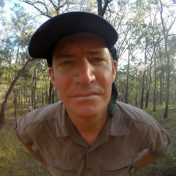
Dr Stuart Phinn, University of Queensland, Australia

Dr Stuart Phinn, University of Queensland, AustraliaStuart Phinn’s research interests are in measuring and monitoring environmental changes using earth observation data and publishing/sharing ecosystem data. He is a professor of Geography at the University of Queensland where he teaches remote sensing and he has established and co-directs the Remote Sensing Research Centre and Joint Remote Sensing Research Program and Australian Earth Observation Coordination Group. Most recently he was the founding director of Australia’s Terrestrial Ecosystem Research Network and its Associate Science Director. He received his PhD from the University of California – Santa Barbara/San Diego State University in 1997. The majority of his work uses images collected from satellite and aircraft, in combination with field measurements, to map and monitor the Earth’s environments and how they are changing over time. This work is done in collaboration with other environmental scientists, government environmental management agencies, NGO’s and private companies. He publishes extensively with his collaborators, and currently has 153 papers in refereed international journals, 1 book, and 11 book chapters. A large part of this work also involves training the next generation of scientists and managers who effectively use remote sensing, and has graduated 36 PhD students. A growing part of this work now focuses on national coordination of Earth observation activities and the collection, publishing and sharing of ecosystem data. |
|
| 12:05 - 12:30 |
Discussion and rapporteur remarks

Professor Yadvinder Malhi, University of Oxford, UK

Professor Yadvinder Malhi, University of Oxford, UKYadvinder Malhi works on understanding the functioning of forests, and in particular tropical forests, and how this function is affected by various forces of global change. His is coordinator of the Global Ecosystems Monitoring network, which conducts intensive monitoring of one hectare forest plots at sites around the world, including the Amazon and Andes, West and Central Africa, and Borneo, and at Wytham Woods near Oxford. A number of these sites have hosted terrestrial laser scanning collection efforts in recent years, and a key focus of his team's research efforts is to understanding what ecological insights can be derived from such data, including into the structure, performance and architecture of trees, and how these vary according to environment and phylogeny. |
Chair
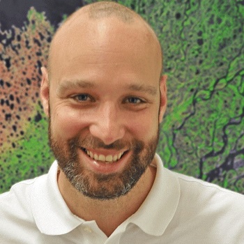
Dr Felix Morsdorf, University of Zurich, Switzerland

Dr Felix Morsdorf, University of Zurich, Switzerland
Felix Morsdorf (FM) received his MSc in Physical Oceanography in 2001 from University of Kiel, Germany and his PhD in Geography with emphasis on LiDAR remote sensing from the University of Zürich, Switzerland in 2007. After that, he spent his post-doc as a researcher at the University of Edinburgh, Scotland, where he contributed to developing a multi-spectral LIDAR for vegetation studies. Since 2010, he is a group leader at the Remote Sensing Laboratories in Zürich, working on laser scanning and vegetation structure. The research groups uses state-of-the-art approaches in physical modelling to advance the understanding and usage of laser scanning in forestry, using both ground-based and airborne laser scanners. FM has served as a consultant in many laser scanning projects for Swiss authorities, transferring knowledge from the group’s research to real-world applications. FM has developed and taught modules on airborne laser scanning at both the undergraduate and graduate level and has (co-)supervised 5 PhD, 10 MsC and 19 BsC students. He has published 41 papers in peer-reviewed journals and serves on the editorial board of Remote Sensing of Environment.
| 13:30 - 14:10 |
Multispectral laser technologies
Multispectral laser technologies are becoming more and more common in Laser Scanning (TLS). Several manufacturers already offer commercial dual or three wavelength airborne laser scanners (Optech Titan being the first one), while multispectral TLS is still carried out mainly with research instruments. Currently, multispectral TLS is mainly based on two different approaches: either two (or more) separate lasers or a supercontinuum or tuneable laser (no simultaneous multi-wavelength measurement) are used as the light source. The advantage in multiple or tuneable laser approach is better signal to noise (S/N) vs. eye safety, as the laser output energy only spans the desired wavelengths, whereas a high output power is needed for supercontinuum lasers to achieve S/N levels sufficient for remote measurement. Another option is to restrict the wavelength range into near-infrared (NIR) for better eye safety. The challenge in the detector side is that it has to be fast and capable of multi-channel data collection. Photodiodes are commonly used together with high-speed digitizers. This talk will discuss the challenges and limitations in multi/hyperspectral lidar development as well as the future prospects related to further development of the technology. The further advances will be closely related to the possible applications, which will also determine the technical solutions that will be adopted and established for the next generation multispectral TLS and their commercial implementation. 
Professor Sanna Kaasalainen, Finnish Geospatial Research Institute, Finland

Professor Sanna Kaasalainen, Finnish Geospatial Research Institute, FinlandSanna Kaasalainen is a research professor at the Finnish Geospatial Research Institute, Department of Navigation and Positioning. She received the Ph.D. degree in astronomy from the University of Helsinki, Helsinki, Finland, in 2003. She is an Adjunct Professor with the Aalto University School of Science and Technology, Espoo, Finland, and a Chair of the International Society for Photogrammetry and Remote Sensing Working Group VII/7, "Synergy in Radar and Lidar." Her current research interests include combining positioning and spatial information to that obtained with optical sensors in environmental monitoring, and the development and applications of hyperspectral laser scanning. |
|
|---|---|---|
| 14:10 - 14:50 |
Full-waveform terrestrial laser scanning
The Dual Wavelength Echidna Lidar (DWEL), a full waveform terrestrial laser scanner (TLS), has been used to scan a variety of forested as well as agricultural environments both independently and in conjunction with other TLS instruments (such as the compact biomass lidar (CBL) and the Riegl VZ400). From these scanning campaigns, the benefits and challenges provided by DWEL’s unique combination of two technologies — coaxial dual-wavelength scanning and full-waveform recording – are summarised. The simultaneous scanning at both 1064 nm and 1548 nm by DWEL instrument provides a joint acquisition of bispectral and spatial features of scanned targets. The point cloud classification algorithm improves the differentiation between leaves and woody matter in forest scans. The quality of the bispectral difference signal, which is used to classify soft vegetative targets, such as leaves and branches that typically partially intercept laser beams, replies upon the accuracy of the challenging coalignment of the two lasers. Furthermore, while full-waveform scans have large volumes and pose demanding data manipulation methods, they retain return pulse shapes that also prove helpful to point cloud classification and gap probability estimation, especially for those soft vegetative targets. In practice, large-scale scanning is currently held back by challenges in instrument design and in the extensive data processing required for coaxial dual- or multi-wavelength scanning and the full-waveform recording. But the simultaneous 3-D acquisition of both spectral and spatial features with these two technologies opens doors to study biophysical and biochemical properties of forested and agricultural ecosystems at more detailed scales. 
Dr Michael Schaefer, CSIRO Land and Water, Australia

Dr Michael Schaefer, CSIRO Land and Water, AustraliaMichael completed his PhD in Physics in 2012 at the University of New England and is currently a Postdoctoral Research Fellow (TERN AusCover) in the School of Science and Technology at the University of New England. Michael is also a member of the Precision Agriculture Research Group (PARG). Based in Canberra, Australia, Michael works in the TERN AusCover Remote Sensing Group where his main roles include using terrestrial and airborne laser scanning for monitoring vegetation, in particular the dual wavelength echidna lidar (DWEL). These laser scan measurements are collected at field sites scattered all over Australia and are utilised to monitor vegetation health, crop vigour and yield as well as other vegetation structural attributes such as above ground biomass. 
Dr Zhan Li, University of Massachusetts Boston, USA

Dr Zhan Li, University of Massachusetts Boston, USAZhan Li received the B.S. degree from Nanjing University, Nanjing, China, in 2008, the M.S. degree from Chinese Academy of Sciences, Beijing, China, in 2011, and the Ph.D. degree in geography from Boston University, Boston, U.S.A., in 2015. After his work on the novel dual-wavelength terrestrial laser scanner, Dual-Wavelength Echidna Lidar (DWEL) with Professor Alan H. Strahler at Boston University, he continues his research interest in characterizing ecosystem structure with terrestrial lidar as a research fellow at the University of Massachusetts, Boston with the School for the Environment. Additionally, he expands his research topics into various Earth observation satellite data, such as MODIS, VIIRS, Landsat and Sentinel-2, for the study of land surface process, especially the surface anisotropy, land surface albedo and their spatiotemporal patterns, through his work in Professor Crystal B. Schaaf’s SPECTRALMASS lab. During his work on DWEL, he set up the protocol for the radiometric calibration of dual-wavelength laser scanners and developed the classification techniques to exploit both spectral and spatial information from bi-spectral lidar scanning data for the differentiation of leaves and woody materials of forests in three-dimensional space. Dr. Li’s previous work also covers the application of Riegl terrestrial lidar to forest inventory, the study of spaceborne lidar, ICESat GLAS for urban environment monitoring, and the exploitation of long-term Landsat images for the mapping and study of wetlands and Antarctic. |
|
| 14:50 - 15:20 | Tea | |
| 15:20 - 16:00 |
Developing the Salford Advanced Laser Canopy Analyser (SALCA)
The Salford Advanced Laser Canopy Analyser (SALCA) is an experimental terrestrial laser scanner designed and built specifically to measure the structural and biophysical properties of forest canopies. SALCA is a pulsed dual-wavelength instrument with co-aligned laser beams recording backscattered energy at 1063 and 1545 nm; it records full-waveform data by sampling the backscattered energy at 1 GHz giving a range resolution of 150 mm. The finest angular sampling resolution is 1 mrad and around 9 million waveforms are recorded over a hemisphere above the tripod-mounted scanner in around 110 minutes. Starting in 2010 data pre-processing and calibration approaches, data analysis and information extraction methods were developed, and a wide range of field experiments conducted. The overall objective is to exploit the spatial, spectral and temporal characteristics of the data to produce ecologically useful information on forest and woodland canopies including leaf area index, plant area volume density and leaf biomass, and to explore the potential for tree species identification and classification. This presentation outlines the key challenges in instrument development, highlights successes in terms of providing new data for forest ecology, and suggests avenues for exploring information-rich data from the next generation of TLS instruments like SALCA. 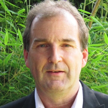
Professor Mark Danson, University of Salford, UK

Professor Mark Danson, University of Salford, UKMark Danson is Professor of Environmental Remote Sensing at the University of Salford. His research interests are in mapping, modelling and understanding environmental change, specifically the effects of climate change and human activity on the biosphere. His focus is on the application of Earth Observation satellite data, airborne remote sensing imagery, and ground-based instruments, to monitor change in forest ecosystems. He recently developed one of world’s first dual-channel full-waveform terrestrial laser scanners, the Salford Advanced Laser Canopy Analyser, that is now being used to record some of the most accurate three-dimensional structural measurements of vegetation canopies ever made. Professor Danson was a Royal Society Leverhulme Trust Senior Research Fellow 2013-14. |
|
| 16:00 - 16:30 |
Dynamic sampling with highly portable Terrestrial Laser Scanners
Terrestrial Laser Scanners (TLS) can acquire detailed 3D models of many ecosystems and environments, including temperate and tropical forests, saltmarshes, mangroves and other coastal ecosystems. From these 3D models features of interest, such as the height of trees, species of grass or volume of creeks, can be measured. However, the Light Detection and Ranging (lidar) technology used by TLS is limited to line-of-sight observations. Therefore, scanning can sometimes miss certain regions or details of an ecosystem, and it is not known that this has happened until back in the lab. The work seeks ways of analysing the TLS scans in the field, on-the-fly, to assess the regions that have not yet been scanned, and objects for which more information is needed. By assessing the TLS scans taken so far, the best location for the next scan can be decided, in order to gain the largest possible amount of useful information. This process is called Dynamic Sampling. Dynamic Sampling methods allows adaption of the number and position of scans so that it can be guaranteed, while still in the field, that there is everything needed to make high quality estimations of ecosystem properties. These methods are particularly applicable to rapid-scanning, highly portable TLS instruments. 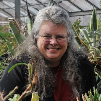
Professor Crystal Schaaf, University of Massachusetts Boston, USA

Professor Crystal Schaaf, University of Massachusetts Boston, USACrystal Schaaf is a Professor in the School for the Environment at the University of Massachusetts Boston. She works on the development of operational albedo and surface anisotropy products as a science team member for NASA's MODerate Resolution Imaging Spectrometer (MODIS) which monitors the Earth's environment from the Terra and Aqua polar-orbiting space platforms. She is also a science team member for the Visible/Infrared Imager/Radiometer Suite (VIIRS) on board the NOAA/NASA Suomi National Polar orbiting Partnership (NPP) and for the Operational Land Imager (OLI) on board the USGS/NASA Landsat-8 satellite platform, as well as a collaborator for the NASA Global Ecosystem Dynamics Investigation (GEDI) space based lidar mission scheduled to fly on the International Space Station (ISS). Her interests include modeling reflectance anisotropy and albedo, using remote sensing data to monitor vegetation disturbance and phenology, modeling carbon fluxes from land to water, and using remotely-sensed anisotropy and albedo products in climate and biogeochemical models. Most recently her research has been focused on the reconstruction of vegetation structure and biomass from terrestrial, airborne and spaceborne lidar systems and multi-angular measures of surface anisotropy 
Dr Ian Paynter, University of Massachusetts Boston, USA

Dr Ian Paynter, University of Massachusetts Boston, USAIan is in the Schaaf/SPECTRALMASS laboratory in the School for the Environment at the University of Massachusetts, Boston, United States. He has a MS in Marine Science and Technology, and a BSc in Zoology. The SPECTRALMASS lab addresses ecological questions through the integration of remote sensing resources with traditional field techniques and emerging modelling approaches. Professor Crystal Schaaf, Principle Investigator for the SPECTRALMASS lab, is a member of the science teams for the LandSat, MODIS and VIIRS satellites, so much of the lab's work involves utilizing these resources to observe ecological states and change, as well as investigating observations from these and other satellite-borne sensors, including the European Space Agency’s Sentinel series. Professor Schaaf’s involvement in the development and utilization of the Echidna Validation Instrument and the Dual-Wavelength Echidna Lidar for forestry characterization led to the SPECTRALMASS lab’s development of the Compact Biomass Lidar (CBL). The CBL is a terrestrial laser scanner optimized for rapid-scanning, portability and ruggedness. The lab has been investigating the ability of this new breed of scanners to observe inaccessible, highly complex, and highly dynamic ecosystems, including tropical forests, mangrove forests and saltmarshes. Additionally, the SPECTRALMASS lab is heavily involved in the Terrestrial Laser Scanner Research Coordination Network, contributing to various improvements to data collection, processing and analysis in forestry research with laser instruments. |
|
| 16:30 - 17:00 |
Discussion and rapporteur remarks

Professor Sanna Kaasalainen, Finnish Geospatial Research Institute, Finland

Professor Sanna Kaasalainen, Finnish Geospatial Research Institute, FinlandSanna Kaasalainen is a research professor at the Finnish Geospatial Research Institute, Department of Navigation and Positioning. She received the Ph.D. degree in astronomy from the University of Helsinki, Helsinki, Finland, in 2003. She is an Adjunct Professor with the Aalto University School of Science and Technology, Espoo, Finland, and a Chair of the International Society for Photogrammetry and Remote Sensing Working Group VII/7, "Synergy in Radar and Lidar." Her current research interests include combining positioning and spatial information to that obtained with optical sensors in environmental monitoring, and the development and applications of hyperspectral laser scanning. |
Chair
Professor Martin Herold, Wageningen University, The Netherlands

Professor Martin Herold, Wageningen University, The Netherlands
Martin Herold is Professor in Geo-Information with emphasis on Remote Sensing at Wageningen University (The Netherlands). His research focuses on large area land and forest monitoring and assessments and the use of novel technologies such as terrestrial lasers to increase accuracy and detail in forest monitoring, and how to include those to approaches to REDD+ monitoring and analysis of land use-related emissions, uncertainties and links to climate change mitigation in tropical countries.
| 09:00 - 09:45 |
Weighting trees with lasers: new measurements of forest biomass and structure
How much does a large tree weigh, let alone all tropical forests? This is an important and perhaps surprisingly difficult question to answer. Trees are a net sink of carbon (C), absorbed from the atmosphere during photosynthesis and can store this C for decades or even centuries. Tropical forests for example store around half of all above-ground terrestrial C, and of course are at risk due to deforestation and degradation, as well as from changing rainfall and temperature patterns. Surprisingly, our knowledge of tropical forest C stocks is highly uncertain (errors of 100% or more in some cases) and with large disagreement between methods. Hence estimates of anthropogenic CO2 emissions due to forest loss and disturbance are also highly uncertain. The only way around this is to cut down trees and weigh them - a hugely challenging, expensive, and, crucially, one-time deal. As a result, all estimates of above-ground biomass, AGB (satellite, field-based etc) are based on indirect empirical allometric (size-to-mass) relationships that are based on extrapolating measurements of a small number of (mostly smaller) harvested trees. This talk will show how new highly-accurate non-destructive terrestrial laser scanning (TLS) measurements can solve this problem. The results suggest that tropical forest allometries are both much more uncertain, and biased than currently thought. The talk will also show how TLS can be used to improve AGB estimates from ground, air and space, as well as to help understand and quantify constraints on large tree form and function. 
Dr Mat Disney, UCL and NERC National Centre for Earth Observation, UK

Dr Mat Disney, UCL and NERC National Centre for Earth Observation, UKDr Mathias (Mat) Disney is Reader in Remote Sensing in the Department of Geography at UCL, and a member of the NERC National Centre for Earth Observation. Mat's background is in physics of light interaction with the terrestrial land surface, particularly vegetation. Mat uses 3D models and measurements of light interaction with vegetation to exploit observations from satellites, aircraft and ground-based instruments, in particular to try and quantify and understand forest ecosystems. Mat has worked in a range of environments including boreal forests, tundra and savannah as well as crops and managed forests, but now focuses on tropical and temperate forests. Mat currently spends a lot of his time making new terrestrial laser scanner measurements in tropical forests to estimate tree size and mass, carbon stocks, and explore links between forest structure and ecosystem function. |
|
|---|---|---|
| 09:45 - 10:25 |
Can lasers measure forest water content?
With the development of multispectral and dual-wavelength terrestrial laser scanners, new opportunities have emerged for measurement of not just forest structure, but also tree biochemistry. Laser scanner intensity can be calibrated to apparent reflectance, allowing the calculation of range-resolved spectral indices, sensitive to biochemical changes but unaffected by background illumination conditions. A reduction in tree canopy water content, measured as Equivalent Water Thickness (EWT), is indicative of drought stress, represents an early sign of many tree pests and diseases and can result in increased risk of forest fires. The ability to monitor canopy water content, including spatial and vertical heterogeneity within the forest canopy, can potentially be of significant benefit to forest management, as well as to our understanding of tree physiology and stress and ability to validate satellite estimates of canopy EWT. A new generation of dual-wavelength terrestrial laser scanners, including the Salford Advanced Laser Canopy Analyser, obtain data in the near and shortwave infrared wavelengths, suitable for the estimation of EWT through a normalised difference index. The results of leaf and canopy-scale experiments are presented, showing the potential of dual-wavelength laser scanning to estimate leaf and canopy EWT in a variety of species and to reveal the spatial and temporal heterogeneity of this parameter within forest canopies. Challenges in separating the effect of canopy water content from the influence of laser incidence angle, partial hits and the presence of woody material are discussed. 
Dr Rachel Gaulton, University of Newcastle, UK

Dr Rachel Gaulton, University of Newcastle, UKRachel Gaulton has been a Lecturer in Remote Sensing at Newcastle University since 2011. With a background in ecology, her research interests lie in the application of remote sensing techniques to ecological and environmental monitoring, with a particular focus on the measurement of vegetation structure, dynamics and health. Current research, examining tree and crop health, aims to advance the measurement of vegetation biochemistry, through the use of imaging, field spectroscopy and terrestrial laser scanning approaches, including the application of ‘next-generation’ dual-wavelength laser scanners. Wider research interests are focussed on the role of ground-based and near ground sensors (including those deployed on unmanned aerial vehicles) in improving understanding of structural complexity, spatial and temporal heterogeneity, and scaling approaches for validation of satellite observations, in both forest and agricultural environments. |
|
| 10:25 - 10:55 | Coffee | |
| 10:55 - 11:35 |
Challenges of plot-based TLS change measurements
Plot-based measurement of carbon dynamics, vegetation phenology and habitat structure are required to understand and predict changes in forest and woodland ecosystems. Rapid developments in Terrestrial Laser Scanning (TLS) instrumentation and data processing methods are offering a step-change in the way ecologists and foresters undertake plot-based forest measurement. However the detection of change poses a number of challenges that have prevented operational use of TLS in regional and continental scale plot monitoring networks, which are of particular importance to forest carbon Measurement, Reporting and Verification (MRV) systems, National Forest Inventories (NFIs), and plans for calibration and validation of canopy structure and aboveground biomass data products from upcoming NASA and ESA spaceborne instruments. Central to the advancement of plot-based change measurement using TLS is: (1) further development of standard protocols for canopy structure and aboveground biomass measurement; and (2) accounting for the propagation of measurement and model error to separate true from false change. The roles, costs and accuracy trade-offs are illustrated in change measurement using commercial instruments capable of 3D geometric reconstruction of forest scenes and permanently deployed low-cost TLS instruments designed for high-temporal resolution monitoring of vertical foliage profiles. Recent case studies that have used these instruments to quantify forest disturbance and phenology driven change at Australian and European sites are presented to highlight challenges in reducing uncertainty in plot-based canopy structure and aboveground biomass change measurement. 
Dr John Armston, University of Maryland, USA

Dr John Armston, University of Maryland, USAJohn received the B.Sc. degree in biology from Macquarie University, Sydney, Australia, in 2001. He has since worked for the Queensland Government as a remote sensing scientist, concurrently receiving the B.Sc. (Hons I 2004) and Ph.D. (2013) degrees in geography from the University of Queensland, Australia. John’s research has been focused on advancing quantitative measurement and mapping of forest and woodland structure using a wide range of remote sensing technology, and the development of validated satellite mapping products over large areas to support Government environmental monitoring programs. John joined the Department of Geographical Sciences at the University of Maryland in April 2016 to work on the NASA Global Ecosystem Dynamics Investigation (GEDI) lidar mission, which aims to greatly increase our knowledge of ecosystem structure and above-ground carbon stores in tropical and temperate forests. |
|
| 11:35 - 12:05 |
Laser scanning and vegetation structure: towards physical-based semantics across scales
Short-range laser scanning with its unique measurement concept holds the potential to revolutionise the way we assess and quantify vegetation structure. Modern laser systems, be it terrestrial or on UAVs provide dense and accurate 3d data whose information “just" waits to be harvested. Simple variables like diameter at breast height (DBH) can be extracted in automated and reproducible fashion. More complex variables (e.g. like leaf area index) need a thorough understanding and consideration of the physical particularities of the measurement process. Tree architecture goes beyond simple structural metrics by adding the topology between the objects constituting the forest or the tree. Still, an intensive dialogue with the user of the information is mandatory to mimic and potentially adapt their concepts of forest structure. The talk will cover some recent applications of short range laser scanning in our group, ranging from crane-based measurements in the tropical rain forest of Borneo to UAV based campaigns in the temperate mixed forests in Switzerland. In addition, this talk will provide some insights into straightforward (QSM) and more advanced applications (ray-tracing) and present a unique reference dataset of 50 urban trees, which have been scanned and cut-down and weighed for biomass. 
Dr Felix Morsdorf, University of Zurich, Switzerland

Dr Felix Morsdorf, University of Zurich, SwitzerlandFelix Morsdorf (FM) received his MSc in Physical Oceanography in 2001 from University of Kiel, Germany and his PhD in Geography with emphasis on LiDAR remote sensing from the University of Zürich, Switzerland in 2007. After that, he spent his post-doc as a researcher at the University of Edinburgh, Scotland, where he contributed to developing a multi-spectral LIDAR for vegetation studies. Since 2010, he is a group leader at the Remote Sensing Laboratories in Zürich, working on laser scanning and vegetation structure. The research groups uses state-of-the-art approaches in physical modelling to advance the understanding and usage of laser scanning in forestry, using both ground-based and airborne laser scanners. FM has served as a consultant in many laser scanning projects for Swiss authorities, transferring knowledge from the group’s research to real-world applications. FM has developed and taught modules on airborne laser scanning at both the undergraduate and graduate level and has (co-)supervised 5 PhD, 10 MsC and 19 BsC students. He has published 41 papers in peer-reviewed journals and serves on the editorial board of Remote Sensing of Environment. |
|
| 12:05 - 12:30 |
Discussion and rapporteur remarks

Dr Mat Disney, UCL and NERC National Centre for Earth Observation, UK

Dr Mat Disney, UCL and NERC National Centre for Earth Observation, UKDr Mathias (Mat) Disney is Reader in Remote Sensing in the Department of Geography at UCL, and a member of the NERC National Centre for Earth Observation. Mat's background is in physics of light interaction with the terrestrial land surface, particularly vegetation. Mat uses 3D models and measurements of light interaction with vegetation to exploit observations from satellites, aircraft and ground-based instruments, in particular to try and quantify and understand forest ecosystems. Mat has worked in a range of environments including boreal forests, tundra and savannah as well as crops and managed forests, but now focuses on tropical and temperate forests. Mat currently spends a lot of his time making new terrestrial laser scanner measurements in tropical forests to estimate tree size and mass, carbon stocks, and explore links between forest structure and ecosystem function. |
Chair

Professor Crystal Schaaf, University of Massachusetts Boston, USA

Professor Crystal Schaaf, University of Massachusetts Boston, USA
Crystal Schaaf is a Professor in the School for the Environment at the University of Massachusetts Boston. She works on the development of operational albedo and surface anisotropy products as a science team member for NASA's MODerate Resolution Imaging Spectrometer (MODIS) which monitors the Earth's environment from the Terra and Aqua polar-orbiting space platforms. She is also a science team member for the Visible/Infrared Imager/Radiometer Suite (VIIRS) on board the NOAA/NASA Suomi National Polar orbiting Partnership (NPP) and for the Operational Land Imager (OLI) on board the USGS/NASA Landsat-8 satellite platform, as well as a collaborator for the NASA Global Ecosystem Dynamics Investigation (GEDI) space based lidar mission scheduled to fly on the International Space Station (ISS).
Her interests include modeling reflectance anisotropy and albedo, using remote sensing data to monitor vegetation disturbance and phenology, modeling carbon fluxes from land to water, and using remotely-sensed anisotropy and albedo products in climate and biogeochemical models. Most recently her research has been focused on the reconstruction of vegetation structure and biomass from terrestrial, airborne and spaceborne lidar systems and multi-angular measures of surface anisotropy
| 13:30 - 14:10 |
New 3D and 4D tree and forest models from laser scanning
Laser scanning techniques have brought about the possibility to model trees and forests efficiently in 3D detail. These quantitative structure models (QSMs) contain any desired geometric, volumetric, and topological properties of the trees. (Raumonen et al. 2013, Rem. Sens. 5, 491. Sample models can be interactively viewed at http://math.tut.fi/inversegroup/treegallery). With the advent of lightweight and mobile scanners, this approach will, for the first time, allow the fast and precise 3D mapping of entire forests from billions of data points. Such models can be used for a wide variety of ecological studies, especially since tree species can be automatically identified from QSMs (Akerblom et al., this meeting and and Rem. Sens. Env., in press). The scheme has been expanded to 4D growth models by modifying theoretical plant growth algorithms to have stochastic components that produce the characteristic structural properties for each species (Potapov et al. 2016, Silva Fenn. 50, 1413). The measurements are made by a large international collaboration network that also develops new types of instruments, such as the hyperspectral lidar that allows the identification of the surface material (chlorophylll, moisture, the condition of the tree, etc.) in addition to the laser scanning point cloud (S. Kaasalainen et al., this meeting). The combination of new methods and instrumentation allows the modelling of forests with unprecedented detail and quality. 
Professor Mikko Kaasalainen, Tampere University of Technology, Finland

Professor Mikko Kaasalainen, Tampere University of Technology, FinlandProfessor Kaasalainen obtained his DPhil at Oxford in 1994, and he has been professor of applied mathematics at Tampere University of Technology since 2009. He uses mathematics as an umbrella science for solving interdisciplinary problems in fields ranging from biology to cosmology. The main common feature in most of these are that they are inverse problems: how reliably can you reconstruct what has caused a given dataset -- can you find the truth out there from limited knowledge? In forest science, Mikko's research group works on building comprehensive new-generation 3D and 4D forest models using big data especially from laser scanning. Mikko is also the vice director of the Centre of Excellence in Inverse Problems funded by the Academy of Finland. The website of his research group at TUT is at math.tut.fi/inversegroup. |
|
|---|---|---|
| 14:10 - 14:50 |
Linking TLS measurements to global forest initiatives
Accurate, timely and transparent forest monitoring is relevant to several international policy processes such the Paris Climate Agreement and the Sustainable Development Goals; in particular keeping progress on progress to reduce deforestation and degradation and enhance forest stocks and functioning. Of particular in there is tropical forest biomass as a crucial component of global carbon emission estimations while large uncertainties on the carbon stocks and carbon stock changes due to human activities remain. Robust estimates require accurate and effective methods to estimate in-situ above ground biomass (AGB) and present methods rely on allometric models that are highly uncertain for many tropical countries and for large tropical trees in particular. In a recent meeting in November 2016 of the Global Observations Forest Initiatives (GFOI), a first synthesis of the potential TLS for supporting country carbon monitoring activities, including: - Improve allometry for tropical trees, reduce underestimation of biomass for large trees given that many countries are using Chave’s equation - Increase transparency and traceability, and ability to produce long-term records of change in canopies and wood damage - Better data to calibrate remote sensing based estimation, plot scale relationships between height, structure and biomass – research topic - Interest for TLS to be tested in/with countries - TLS community effort to make use of already acquired data across tropics to provide more empirical evidence Despite that potential, the uptake of such technologies into national and international reporting requires additional steps and actions, including: - Demonstration on how TLS can contribute to national inventory efforts with countries - Development of community-consensus good practice guidelines based on experiences - Evolve TLS processing to open source solutions - Training materials and capacity development efforts A particular interest of international initiatives is in methods to assess the type and impacts of forest change and to enhance transparency and increase stakeholder participation. These are areas where TLS might contribute even more in the future. 
Professor Martin Herold, Wageningen University, The Netherlands

Professor Martin Herold, Wageningen University, The NetherlandsMartin Herold is Professor in Geo-Information with emphasis on Remote Sensing at Wageningen University (The Netherlands). His research focuses on large area land and forest monitoring and assessments and the use of novel technologies such as terrestrial lasers to increase accuracy and detail in forest monitoring, and how to include those to approaches to REDD+ monitoring and analysis of land use-related emissions, uncertainties and links to climate change mitigation in tropical countries. |
|
| 14:50 - 15:20 | Tea | |
| 15:20 - 16:00 |
Linking ground to space for environmental applications
Australia is one of the largest users of earth observation data world-wide, in part because the overall terrestrial and marine Australian territory that has to be monitored covers about 1/10 of the earth’s surface, and also due to the low population density and limited number of on-ground monitoring systems that operate across this vast territory. The ‘AusCover’ remote sensing facility of the Terrestrial Ecosystem Research Network (TERN), was explicitly designed to help bring many disparate earth observation research teams together, and provide a level of national coordination and standardisation to the data and derived products that they use for both R&D and for use by government natural resources management purposes. This facility has operated since early 2010, and to-date has close to 12 institutional partners. It supports over 30 staff across the country, with eight regional ‘nodes’, that in turn provide important linkages to the various regional users of EO-derived products served via the AusCover data Facility. Among the important ongoing activities performed by the AusCover partnership are to provide ground-based product validation services and in-situ data collection in support of international satellite programs as well as domestic research activities. AusCover has collected 5 km x 5 km high-resolution airborne hyperspectral and lidar data coverages for over ten ‘TERN Supersites’ across the continent that are complimented by detailed ground-based terrestrial lidar and other ancillary measurements at each site. This paper will highlight some of the results from this intensive field, and airborne work, and how it is being used for scaling to larger-scale regional or continental-scale products. 
Dr Michael Schaefer, CSIRO Land and Water, Australia

Dr Michael Schaefer, CSIRO Land and Water, AustraliaMichael completed his PhD in Physics in 2012 at the University of New England and is currently a Postdoctoral Research Fellow (TERN AusCover) in the School of Science and Technology at the University of New England. Michael is also a member of the Precision Agriculture Research Group (PARG). Based in Canberra, Australia, Michael works in the TERN AusCover Remote Sensing Group where his main roles include using terrestrial and airborne laser scanning for monitoring vegetation, in particular the dual wavelength echidna lidar (DWEL). These laser scan measurements are collected at field sites scattered all over Australia and are utilised to monitor vegetation health, crop vigour and yield as well as other vegetation structural attributes such as above ground biomass. |
|
| 16:00 - 16:30 |
Coordinating TLS research for ecological applications
Enhancing the development of terrestrial laser scanning (TLS) for ecological applications is the objective of a Research Coordination Network (RCN) now funded by the US National Science Foundation. The activity has two primary goals: (1) development of a low-cost lidar scanner that will provide accurate estimates of above-ground forest biomass for carbon modeling and monitoring procedures; and (2) development of a range of new ecological applications for TLS, based on rapid forest structure measurements and 3-D reconstructions of forest plots and stands. The network, first constituted in 2015, presently includes 73 participants, including researchers, professors, postdocs, and students at 32 institutions from Australia, Belgium, Canada, China, Finland, Netherlands, Switzerland, United Kingdom, and the United States. A primary activity of the TLSRCN is to facilitate communication of TLS developments and applications both within the group and to the broader scientific community at meetings and workshops. In 2015-2016, RCN participants presented 40 TLS papers and posters at international meetings and forums. Within the group, bimonthly telecons allow the exchange of recent research developments and planning for group meetings and international conference presentations. Encouraging collaborative publications is also a focus of the RCN; 12 of 15 journal papers published in 2015-2016 that reported TLS research by participants also combined authors from more than one research group participating in the network. Through these efforts, the TLSRCN has demonstrated that research coordination can enhance efforts to advance science and increase collaboration among researchers and groups. The TLSRCN is supported by NSF Grant DBI-1455636. 
Professor Alan Strahler, Boston University, USA

Professor Alan Strahler, Boston University, USAAlan Strahler, Professor Emeritus in the Department of Earth and Environment at Boston University, in Boston, Massachusetts, USA, has been among the leaders of the development of terrestrial lidar scanning for applications in forestry and forest ecology for a decade, and continues to participate in this development as the Principal Investigator of a project entitled Research Coordination Network: Coordinating the Development of Terrestrial Lidar Scanning for Aboveground Biomass and Ecological Applications, supported by the US National Science Foundation. Strahler turned his interest toward terrestrial lidar scanning after a long career in satellite remote sensing of the Earth’s land surfaces, focusing on the theory of vegetation sensing and imaging as related to 2- and 3-D vegetation structure. His early work used NASA’s Landsat satellite series to map American forest types and carry out forest inventory in California. He later led the development of two scientific data products, global land cover and global surface albedo, derived from NASA’s MODIS instruments. His work was recognized with the William T. Pecora Award for Outstanding Contributions to Understanding the Earth by Means of Remote Sensing in 2011, given by the US Department of Interior and NASA. He is also the author or co-author of nine college textbook titles in 23 editions on introductory physical geography. His research and teaching contributions were acknowledged in the award of the honorary DSHC from the Université Catholique de Louvain, Belgium in 2000. A Fellow of the American Association for the Advancement of Science, he has recorded 295 scientific publications to date. |
|
| 16:30 - 17:00 |
Summary of discussions and rapporteur remarks

Professor Alan Strahler, Boston University, USA

Professor Alan Strahler, Boston University, USAAlan Strahler, Professor Emeritus in the Department of Earth and Environment at Boston University, in Boston, Massachusetts, USA, has been among the leaders of the development of terrestrial lidar scanning for applications in forestry and forest ecology for a decade, and continues to participate in this development as the Principal Investigator of a project entitled Research Coordination Network: Coordinating the Development of Terrestrial Lidar Scanning for Aboveground Biomass and Ecological Applications, supported by the US National Science Foundation. Strahler turned his interest toward terrestrial lidar scanning after a long career in satellite remote sensing of the Earth’s land surfaces, focusing on the theory of vegetation sensing and imaging as related to 2- and 3-D vegetation structure. His early work used NASA’s Landsat satellite series to map American forest types and carry out forest inventory in California. He later led the development of two scientific data products, global land cover and global surface albedo, derived from NASA’s MODIS instruments. His work was recognized with the William T. Pecora Award for Outstanding Contributions to Understanding the Earth by Means of Remote Sensing in 2011, given by the US Department of Interior and NASA. He is also the author or co-author of nine college textbook titles in 23 editions on introductory physical geography. His research and teaching contributions were acknowledged in the award of the honorary DSHC from the Université Catholique de Louvain, Belgium in 2000. A Fellow of the American Association for the Advancement of Science, he has recorded 295 scientific publications to date. |
