Links to external sources may no longer work as intended. The content may not represent the latest thinking in this area or the Society’s current position on the topic.
Lost and future worlds: marine palaeolandscapes and the historic impact of long-term climate change
Theo Murphy international scientific meeting organised by Professor Vincent Gaffney, Professor Geoff Bailey, Dr Richard Bates, Dr Philip Murgatroyd, Dr Eugene Ch'ng and Professor Robin G. Allaby.
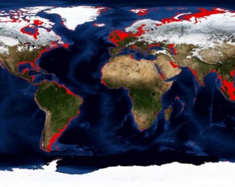
Global warming following the last glacial maximum led to the global submergence of vast, populated landscapes. These largely unexplored lands hold a unique record of habitation linked to climate change. Frequently inaccessible, and unamenable to conventional analysis, this meeting brings together experts across historical and scientific disciplines to identify new analytical methods and the contemporary relevance of these lost lands.
A draft programme (PDF) is available to download. The speaker biographies and abstracts will be available shortly. Recorded audio of the presentations will be available on this page after the meeting has taken place.
Enquiries: Contact the Scientific Programmes team.
Organisers
Schedule
Chair
Dr Richard Bates, University of St Andrews

Dr Richard Bates, University of St Andrews
Dr Bates is an applied geophysicist who began his career in the US contracting to mining, hydrocarbon, ground water and environmental industries. Since returning to the UK and joining the University of St Andrews his focus has been on applying geoscientific techniques to a range of applied research areas in particular with relevance to climate change studies and the reconstruction of past environments and landscapes. Recent European-based research has focused on Doggerland and the ancient people of Britain at field sites from the southern coast to the far northern isles. International projects include reconstructions along the African and Arabian shores, the Caspian Sea and Arctic Greenland-Canada.
| 09:05 - 09:30 |
An odyssey: ancient coasts and waterlands
Alice Roberts explores the importance of coastal routes to our ancient ancestors, colonising the globe in the Palaeolithic, and looks at sites through prehistory which show how humans exploited and adapted to watery places, from Pinnacle Point in South Africa to the earliest humans in the Americas, and the Bronze and Iron Age landscapes of the Somerset levels and the Cambridgeshire Fens. Submerged landscapes hold the key to understanding so much about our ancestors, but can the ancients’ flexible approach to their environment also hold lessons for us, today? 
Professor Alice Roberts, University of Birmingham

Professor Alice Roberts, University of BirminghamAlice Roberts is an anthropologist, author and broadcaster, and Professor of Public Engagement in Science at the University of Birmingham. She is an honorary fellow of the British Science Association and a Fellow of the Royal Society of Biology. She has received honorary doctorates from Royal Holloway University of London, Bournemouth University, Sussex University and the Open University. Alice has presented a wide range of television programmes, often considering the role of climate and environment in the evolutionary trajectories of humans and other species. One of the original presenters of BBC 2’s long-running Coast series, she went on to present many other programmes and series for BBC2 and BBC4, including The Incredible Human Journey, Digging for Britain, several Horizon programmes, Origins of Us, Ice Age Giants and Digging for Britain. She is also a regular presenter on Radio 4’s environment series, Costing the Earth. She has written seven popular science books. Her book on human embryology and evolution, The Incredible unlikeliness of Being, was shortlisted for the Wellcome Trust Book Prize in 2015. |
|
|---|---|---|
| 09:45 - 10:15 |
The devil is in the detail: palaeo-environments and logistics for calibrated regional modelling of prehistoric people living on now submerged continental shelf
Inundated and submerged prehistoric landscapes on the continental shelf have been studied internationally for decades, but, in the early years, only by individual scholars and local research groups. The academic and political status of the topic has increased recently and the value of the research has been noted in the 72nd session of the Oceans and Law of the Sea report to the Secretary General of the United Nations for 2017. There are no formal national or multi-national commitments specifically to this research area, although numerous treaties, conventions and regional agreements are structured in such a way that submerged landscapes and prehistoric sites are included in their provisions. The definition of Underwater Cultural Heritage in the UNESCO Convention includes prehistoric sites, as does the United Nations Convention on the Law of the Sea. In Europe DG-MARE recognises the value of mapping submerged landscapes, and maps and data bases are being developed by EMODNet. The European Marine Board and the European Archaeology Council supported the publication of a joint report on the subject. Regional groups such as SINCOS and NSPRMF have supported work in the Baltic and the North Sea, while a longstanding sequence of INQUA-IGCP projects has been organised in the Black Sea. In the USA NOAA has a budget line for submerged landscapes, while the SPLASHCOS project supported by the COST Action Office integrated available data across the European seas with budget support for 4 years. As yet there are no permanent institutional or treaty-type commitments specifically aimed at supporting submerged landscape research, and this is a point of weakness. Everything still depends on individuals persuading their host institutions or agencies to provide support for the research. In spite of the high status of some of the support being provided, and the excellent research undertaken in many countries, the financial support is still minimal, and there are no long term commitments or funded institutions 
Dr Nicholas Flemming, National Oceanography Centre

Dr Nicholas Flemming, National Oceanography CentreDr Flemming has, since 1960, studied Pleistocene and Holocene relative sea level change and its interaction with prehistoric archaeological indicators. Most of his work before 1980 was in the Mediterranean, but more recent studies have been in North Australia, the Middle East, and the southern Red Sea. He co-edited the first global review of known seabed prehistoric sites, which was published in 1983. In 2002 he convened an international meeting to integrate prehistoric studies in the North Sea, and in 2008 was active in launching the Deukalion and SPLASHCOS projects studying the European continental shelf. He has recently edited the SPLASHCOS volume on European Continental Shelf Palaeoenvironments, and has published a review of the connection between human submerged prehistoric landscapes with identified archaeological sites and their role in ground-truthing global human dispersal where part of the route was probably on the continental shelf. |
|
| 11:00 - 11:30 |
Reconstructing shorelines and landscapes during glacial cycles
Landscapes have evolved throughout geological time through a combination of geological and climatic processes. On the time scale of Homo sapiens the dominant physical changes in global landscapes are a consequence of the ice ages with their concomitant rise and fall in sea level and flooding and re-emergence of the continental shelfs and islands. Flood legends from many parts of the world attest that humans have attempted to explain their experiences of these changes within their framework of knowledge and the present discussion on the subject is one further step in that process. As ice sheets wax and wane, sea levels globally and on average, rise and fall in unison. But the local or regional response can vary significantly from place to place due to the response of the planet to the redistribution of ice and water. The Earth deforms internally and surficially in response to these changes and the ocean surface re-adjusts to this new shape and associated changes in gravity. This response is not instantaneous but lags behind the glacial cycle by amounts that are geography dependent. The result is a complex spatially and temporally variable global pattern of sea level change that cannot be adequately represented by simple concepts such as eustasy but one that contains important information on both the response of the Earth to forcing and of the glacial history. Such variability is indeed observed world-wide but the evidence is sufficiently incomplete and often imprecise to give a comprehensive description of this change. Thus physics-based models, founded in well-tested theories and observations from other geophysical and geological disciplines, have provided the means to interpolate between the disparate observations and to provide a predictive capability of sea level change and shoreline migration (always putting aside that the glacial cycle is not the only process that operates). These models and their limitations will be discussed in this presentation, tested against observational evidence, and used to reconstruct coastal landscapes for some of the regions that may be relevant to some of the following presentations during this meeting. 
Professor Kurt Lambeck, Australian National University

Professor Kurt Lambeck, Australian National UniversityKurt Lambeck FAA, FRS, is Emeritus Professor at the Australian National University; since 2011, a periodic visiting professor at the Ecole Normal Supérieure in Paris, and the 2016-2017 Johannes Geiss Fellow at the International Space Science Institute in Berne. His current research interests are in the relationship between ice sheets oceans and the solid Earth through glacial cycles, including the consequences on past landscapes and human movements. |
|
| 11:45 - 12:15 |
Mapping the land
Very high resolution (VHR) seismic imaging of buried palaeolandscapes in the southern North Sea poses a number of problems. The often sandy sea floor induces strong multiples that may obscure the data especially in shallow water (<10-15 m). Detailed imaging below sand banks is difficult because the short wavelength sound waves are quickly absorbed in the heterogeneous sandy sediments. Intertidal areas furthermore add additional challenges due to highly variable water depth (0-5m), wave action and strong currents. Within the framework of the SeArch project (www.sea-arch.be) an efficient survey methodology was developed for archaeological prospection of the subtidal and intertidal area. In the subtidal area this was done through the comparison of a range of seismic sources (covering a wide range of the frequency spectrum) and receiver combinations. The results show that sparker sources generally provide the best trade-off between image resolution and penetration depth. Surprisingly, multichannel recording significantly improved the image resolution already for shallow target depths. In the intertidal area a novel technique based on multi-transducer parametric echosounding was applied. This resulted in ultra-high resolution 3D images of the shallow sub-bottom (cm/dm range). Grid cell sizes as small as 20x20cm allowed to identify buried features in unprecedented detail. This opens important new perspectives for archaeological prospection in shallow water areas. 
Dr Tine Missiaen, Ghent University

Dr Tine Missiaen, Ghent UniversityDr Tine Missiaen has been involved in marine acoustic research since 1988. Since 1990 she has mainly been working at Ghent University, besides a short intermezzo in France (Ifremer, Centre de Brest) and a number of years part-time involvement in the Netherlands (Delft Technical University). Main research topics include very high resolution 2D and 3D seismic data acquisition/processing/interpretation, geo-acoustic parameter studies, subbottom imaging in intertidal areas and land-sea boundary areas, acoustic studies of shallow (biogenic) gas, munition dumpsite research, as well as non-conventional acoustic techniques for engineering and environmental studies. In recent years her research focus has been largely on marine archaeological studies, specifically the mapping of submerged prehistoric palaeolandscapes and detection/identification of buried archaeological remnants. At present she is coordinator of the successful Belgian research project ‘SeArch’ (Archaeological heritage in the North Sea; www.sea-arch.be). |
Chair
Professor Nicky Milner, University of York

Professor Nicky Milner, University of York
Professor Nicky Milner completed her BA in Archaeology at Nottingham and a PhD at Cambridge in 1998. She received a Sir James Knott fellowship at the University of Newcastle and then a lectureship, before moving to the University of York in 2004. Her research focuses on the Mesolithic period and the Mesolithic-Neolithic transition and tends to divide across three key themes: palaeodiet and consumption practices; settlement and mobility; death and burial. She has worked on shell midden sites in Denmark, Ireland, Scotland, Spain and Portugal and excavated on many sites including Star Carr. She currently runs the ERC funded POSTGLACIAL project associating climatic and environmental data with evidence for human occupation in Britain, shortly after the end of the last Ice Age.
| 13:30 - 14:00 |
Solving for the unknown: the dynamics of drowned archaeological landscapes and early marine resources use. Examples off northwestern Australia
Occupation in Australia is now dated back to 50 ky BP, and for the bulk of this period sea level was lower than present. Nearly one-third of Australia’s landmass, hence a significant part of the archaeological record, was drowned by the post-glacial transgression. Despite this, research aimed at finding submerged prehistoric archaeology on the drowned shelf is only just beginning. Over the next few years, a pioneering, multi-disciplinary study of submerged landscape archaeology will investigate the records of the now-submerged Pilbara coast in NW Australia (spanning 50 to 7 ky BP) and contribute a unique southern hemisphere insight into world prehistory. For Australia’s NW Shelf, knowledge is increasing rapidly on its preserved drowned palaeoshorelines through use of high-resolution remote sensing data, palaeotidal and 3D modelling. Computer-based visualisations, which overlay relative post-glacial sea levels on the modern bathymetry, help conceptual understanding of the changing coastal landscape. However, the past development of coastal resources, their potential human use and the preservation of this in the archaeological record is primarily controlled not by sea level per se but by second and third-order effects associated with variations in coastal sedimentary environments. Considering such physical processes in archaeological thinking will help and improve targeted prospection of submerged cultural sites, and will help stimulate new ways to include such information in conceptual models of human occupation and help us solve for the unknown. 
Dr Ingrid Ward, Flinders University

Dr Ingrid Ward, Flinders UniversityDr Ward's background is multidisciplinary, including geological and archaeological research of terrestrial and marine environments. She has worked in Australian and UK academic, consultancy and regulatory organisations, including English Heritage, where she became interested in submerged landscapes of the southern North Sea. Since returning to Australia in 2011, she has promoted work on the prehistory of submerged landscapes, particularly off NW Australia. In the last few years she has performed geoarchaeological research on an offshore island site (Barrow Island), where cave records preserve a record of occupation from ~ 53 ky BP and provides the earliest Australasian evidence for marine resource use by modern humans. Recently, with European and Australian colleagues, we have received funding to explore what is known to Indigenous Australians as Sea Country. This 3-yr project will investigate submerged sites off the Pilbara coast spanning ~ 50 ka, providing a unique southern hemisphere insight into world prehistory. |
|
|---|---|---|
| 14:15 - 14:45 |
The Bering Land Bridge during the last glacial maximum: a good place to live?
Human DNA evidence of living populations suggests that between ~30,000 and ~15,000 yr BP, people paused in their migration into the New World from Siberia. Where did they pause? Was the now-submerged Bering Land Bridge (BLB) a suitable place to live? Vegetation reconstructions based on a variety of proxies (pollen, plant macrofossils, aDNA) indicate wide-spread herb-dominated tundra on the BLB, though there is intriguing evidence that woody taxa may have been more abundant than is generally assumed. Full glacial and late glacial pollen distribution maps from across Beringia, of which the BLB is only the central region, suggest in situ expansion of key taxa (cottonwood/aspen, spruce, pine, birch, and alder) and not migration from outside the region. In addition, DNA results on modern spruce indicate long isolation of Alaskan populations from those growing south of the Laurentide ice sheet, suggesting that some Alaskan populations could have survived the last glacial age in Beringia. Finally, some localities on the BLB may have been somewhat mesic, thus providing suitable habitat for the woody taxa to occupy. However, issues with chronology, site taphonomy, and pollen-vegetation linkages do cloud the issue. This presentation summarises current data on the BLB and adjacent regions and presents the pros and cons of the BLB as a suitable landscape for long-term human occupation. 
Dr Nancy Bigelow, University of Alaska

Dr Nancy Bigelow, University of AlaskaVegetation and landscape change in Beringia (the Bering Land Bridge and adjacent landmasses) are the foci of Nancy Bigelow's research. Using pollen and plant macrofossil remains, she reconstructs Beringian landscape at a variety of spatial scales and over a variety of time periods from the Last Interglacial (125,000 years ago) through the late Holocene. Most recently her interests have focused on the landscape as people would have encountered it. Specifically, were woody plants present, either during the last ice age, or at high elevations during the Holocene? Has there been anthropogenic alteration of the landscape? And do large-scale vegetation groups (biomes) shed light on local plant availability? Bigelow’s research is highly collaborative and it is only through multi-proxy studies that these questions can be addressed. |
|
| 15:30 - 16:00 |
Pathways to Ancient Britain
The Pleistocene occupation of northwest Europe occurred during a period characterised by significant climatic changes. In Britain, hominin populations were present discontinuously through varied climates, from cool continental sites such as Happisburgh 1 and 3, to the balmy Mediterranean conditions of Pakefield. Whilst apparently able to survive through a range of conditions, the configuration of these landscapes, in particular the presence or absence of a land connection with the continent, would have had a fundamental impact on the density of hominin occupation in Britain at any given time. Similarly, the ecologies once present in the now-drowned North Sea Basin and Channel regions would presumably have played an important role in attracting and sustaining sporadic hominin populations. However, our understanding of the physical and environmental character of these landscapes, as well as the timing of transgressive and regressive periods, remains frustratingly murky, hindering the ability to imagine how these landscapes may have been used. A growing body of data from recent research and commercial offshore development is, however, beginning to address this issue: we can now start to piece together a more coherent picture of landscapes through time, but there is still an immense amount of work to do. By drawing some of this recent work together, this paper will discuss the potential configuration of these landscapes throughout the Pleistocene, the impact of fluctuating climatic changes upon them and the resulting implications for the hominins they sustained. 
Dr Rachel Bynoe, University of Southampton

Dr Rachel Bynoe, University of SouthamptonRachel is a Palaeolithic archaeologist specialising in submerged archaeology, particularly of the North Sea basin. She completed her PhD at the University of Southampton in 2014 looking at the use of historic faunal remains to locate extant Pleistocene deposits in the North Sea. In the intervening years she has lectured on both Palaeolithic and maritime courses and continued to work on terrestrial and submerged sites, including the only diver-groundtruthed Pleistocene sites in the UK. Currently Rachel is in the middle of a post-doctoral research position at the Natural History Museum as part of the Pathways to Ancient Britain project, concentrating on developing methods to locate and investigate the submerged deposits off Happisburgh, Norfolk. |
|
| 16:15 - 16:45 |
Beringia and the Arctic: submerged landscapes and receding glaciers
Events following the last glacial maximum (LGM) in high latitudes of North America illustrate the “push–pull” impacts of rising sea level and glacial recession on human and biotic communities. These forcing mechanisms transformed northern North America resulting in: 1) separating the vast land connection between Asia and North America, 2) joining the Arctic and Pacific Oceans, 3) landward retreat (push) of human and near-shore biotic communities in response to rising sea level, and 4) the colonization (pull) of biota and humans in newly deglaciated regions. Understanding and quantifying the timing and mechanisms of this dramatic reconfiguration of North America provides insights for the application of complex systems modeling to geographically predict and scale future “push-pull” events likely to result from climate change. 
Professor Emeritus E. James Dixon, University of New Mexico

Professor Emeritus E. James Dixon, University of New MexicoE. James Dixon served as Professor of Anthropology and Curator of Archeology at the University of Alaska Museum from (1974–1993). He became curator of archeology at the Denver Museum of Nature and Science in 1993 and subsequently (2001–2007) joined the faculty at the University of Colorado as Professor of Anthropology and Research Fellow at the Institute of Arctic and Alpine Research. He served as Professor of Anthropology and Director of the Maxwell Museum of Anthropology at the University of New Mexico (2007–2016). After attending Fairleigh Dickenson University, he enrolled in the University of Alaska, Fairbanks where he received his B.A. and M.A., and then attended Brown University where he received his Ph.D. He was a Marshall Fellow for research at the National Museum of Denmark in 1972, a National Endowment for the Humanities Fellow in 1996-97, and awarded the Alaska Anthropological Association’s Professional Achievement Award in 2007. He specializes in North American archeology with particular focus on human colonization, high altitude and high latitude human adaptations, and early cultural development in the Americas. He has led many large research projects and advised and participated in numerous educational films, videos, and museum exhibitions. He also has lectured and published extensively including three books, Quest for the Origins of the First Americans (1993), Bones, Boats & Bison: Archaeology and the First Colonization of Western North America (1999), and Arrows and Atl Atls: A guide to the Archeology of Beringia (2013). |
Chair
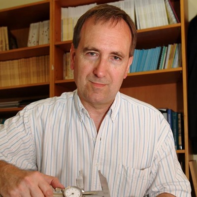
Professor Chris Stringer FRS, Natural History Museum, UK

Professor Chris Stringer FRS, Natural History Museum, UK
Professor Chris Stringer has worked at the Natural History Museum since 1973, and is now Research Leader in Human Origins and a Fellow of the Royal Society. His early research concentrated on the relationship of Neanderthals and early modern humans in Europe, but through his work on the 'Recent African Origin' model, he now collaborates with archaeologists, dating specialists and geneticists in attempting to reconstruct the evolution of modern humans globally. He has excavated at sites in Britain and abroad, directed the Ancient Human Occupation of Britain project (AHOB) for 13 years, and now co-directs the Pathways to Ancient Britain project (PAB). His recent books include The Origin of our Species (published in the USA as Lone Survivors, 2013) and Britain: one million years of the human story (with Rob Dinnis, 2014).
| 09:00 - 09:30 |
Climate, sea level change, coastline migration and human adaptive strategies in the Black Sea region
This presentation focuses on the study of the evolution and interrelationship of the environment and prehistoric populations in the northwestern part of the Black Sea during last 30 kyr. At the LGM (27–17 ka BP), when the level of the Early Neoeuxinian lake was at least 100 m BSL on the northwestern coast, we would expect Upper Paleolithic sites to be located within the deep valleys of small rivers. These valleys were flooded in the course of the Late Neoeuxinian transgression (17–10 ka BP); however, they are well expressed geomorphologically and can be easily traced on the present Black Sea shelf. This topographic information can be used to search for submerged Upper Paleolithic sites on the shelf, thereby helping to locate evidence for the transition among ancient human groups from hunting large herd animals to small non-gregarious species. The beginning of the Mediterranean transgression occurred around 9.5 ka BP. Both the transgression and faunal migration occurred over the course of six transgressive-regressive stages. Mesolithic sites continued to be located along river valleys; they bear some evidence of the transition from hunting to gathering of edible plants. No signs of catastrophic flooding of the Black Sea in the Early Holocene have been found (Yanko-Hombach et al. 2013). Geoarchaeological modeling of the northwestern Black Sea region over 30 kyr with respect to paleoenvironment and settlement pattern mapping enabled to shed light on submerged prehistoric site prospecting. 
Professor Valentina Yanko, Odessa University

Professor Valentina Yanko, Odessa UniversityProfessor Yanko is the Head of the Department of Physical and Marine Geology and Director of the Scientific and Educational Center of Geoarchaeology, Marine and Environmental Geology at Odessa I.I. Mechnikov National University, Ukraine. Her principal areas of expertise include marine geology and geoacrchaeology with the main accent on climate, sea level change, coastline migration, and human adaptive strategies in the Capstan-Black Sea-Mediterranean Corridors during the Quaternary. She is a member of the Geological Society of America, Micropalaeontological Society, Cushman Foundation for Foraminiferal Research, INQUA, European Coastal Union, International Association for Promoting Geoethics, Ukrainian Society of Mineralogists, and Ukrainian Geological Society. Fluent in several languages and working easily in both East and West, she is devoting her energies to bringing together internationally recognized experts on the geological and archaeological history of the Corridors to integrate sedimentological, paleontological, and archaeological data, synthesis a vast amount of non-English literature, and bridge perceived and actual barriers between eastern and western researchers. She was a founder and past-president of the International Society of Environmental Micropalaeontology, Microbiology and Meiobenthology and president/executive director of IGCP 521, 610 Plenary conferences as well as a plenary speaker and session convener at IGU, EGU, GSA, and INQUA congresses. |
|
|---|---|---|
| 09:45 - 10:15 |
'Through Sunda to Sahul' and look at sea level human dispersal issues in island South East Asia
Anatomically Modern Humans (AMHs) dispersed rapidly through Sunda, Wallacea and across much of Sahul (Australia and New Guinea joined at times of lowered sea level) by around 50,000 years ago. The establishment of a viable founder population in Sahul from the islands of Wallacea necessarily involved several prior water crossings. Multiple routes through Wallacea to Sahul have been proposed and all involve at least one open ocean, multi-day voyage approaching 100 km. This paper will first consider the constraints and opportunities imposed by the palaeoenvironments and palaeogeography of the region at the time of human dispersal. It will present new high-resolution bathymetry and drift simulation evidence that a purposeful crossing between inter-visible locations was likely from Timor-Roti to islands exposed by lowered sea level, from which Sahul itself was readily accessible. The crossing required an open ocean journey of 3-6 days. Consideration of the genetic evidence suggests this founder population numbered at least ~50 individuals. We further suggest the possibility that two broadly synchronous arrivals of genetically divergent populations occurred, one from the south (Timor to northwest Australia) and one from the north (via the Bird’s Head Peninsula into New Guinea). We finally review the evidence for colonization routes into Sahul itself. 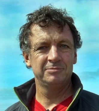
Professor Michael Bird, James Cook University

Professor Michael Bird, James Cook UniversityMichael Bird trained as a geologist at the University of Sydney and the Australian National University, obtaining a PhD in isotope geochemistry in 1988. Following a postdoctoral fellowship at the University of Western Ontario in Canada, he returned to Australia as research Fellow, Queen Elizabeth II Fellow and Fellow at the Research School of Earth Sciences, Australian National University. In 2000 he took up an Associate Professorship in Singapore and in 2004 moved to the Chair in Environmental Change at the University of St. Andrews in Scotland. He returned again to Australia in 2009 to take up an Australian Research Council Federation Fellowship. He is currently an ARC Laureate Fellow and Distinguished Professor in the College of Science and Engineering at James Cook University (Cairns campus). He leads a research group focused on environmental change and geoarchaeology in tropical Australia and Southeast Asia. |
|
| 11:00 - 11:30 |
Archaeogenetics
Phylogeography is an approach to genetic data that combines a phylogenetic tree of non-recombining genetic lineages with the ographical distribution of the lineages and an estimated time depth using the molecular clock – increasingly supported by direct evidence from ancient DNA. The approach was initially applied to the maternally inherited human mitochondrial DNA (mtDNA) but has been applied with increasing success in recent years to Y-chromosome variation, which can now be assessed in great detail at the level of very large stretches of sequence data, and is in principle applicable as well to non-recombining haplotype blocks within the rest of the human genome. The results from mtDNA (in contrast to those from the Y chromosome) have frequently been interpreted in terms of the demographic impact of climate change: many European lineages seem to have been dispersed from refugia with the warming after the end of the Last Glacial Maximum, and many in Southeast Asia seem to have spread as a result of sea-level changes in the early Holocene. Moreover, the initial settlement of Eurasia and Australasia, proposed from mtDNA evidence to have been initially via the southern coastal route out of Africa, and events leading to it within central and eastern Africa, may have been a response to climatic processes at that time. This talk will explain and discuss the evidence for each of these processes and suggest avenues for further investigation. 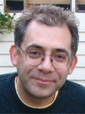
Professor Martin Richards, University of Huddersfield, UK

Professor Martin Richards, University of Huddersfield, UKMartin B. Richards is Professor of Archaeogenetics at the University of Huddersfield, UK. He studied genetics at the Universities of Sheffield and Manchester, moving to the University of Oxford and into archaeogenetic research in 1990. He subsequently moved to UCL, the University of Huddersfield, the University of Leeds, and finally back to Huddersfield in 2012, to take up a Research Chair in Archaeogenetics. His research, with colleagues from across the world (especially Portugal, Italy, Spain, Germany and the UK), has particularly sought to apply whole-mtDNA genome variation to archaeogenetic questions, such as the route taken by modern humans dispersing out of Africa and the settlement of Southeast Asia and the Pacific – most recently returning to the controversy over the settlement of Europe, with a broadening focus to take in genome-wide variation and palaeogenetics. He co-edited Mitochondrial DNA and the Evolution of Homo Sapiens (Springer-Verlag, 2006) with Hans-Jürgen Bandelt and Vincent Macaulay, and he currently runs a Leverhulme Doctoral Scholarship programme in evolutionary genomics, entitled Genetic Journeys into History: The Next Generation, in the School of Applied Sciences at Huddersfield. |
|
| 11:45 - 12:15 |
Reconstructing palaeoenvironments from sedaDNA
Typical sources of ancient DNA, such as plant and animal remains, are often very limited in the archaeological record, and thus are highly valuable. The ubiquity of sources of sediment, from which sediment DNA (sedaDNA) can be extracted, and the favourable conditions for DNA preservation provided by some sediment types has led to an increase its exploitation as a source of aDNA. sedaDNA can be used as a tool for the reconstruction of palaeoenvironements, including the study of human-environment interactions, changes in environmental conditions, and of mass floral or faunal extinction events. 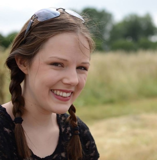
Dr Roselyn Ware, University of Warwick

Dr Roselyn Ware, University of WarwickRoselyn is post-doctoral researcher based at the University of Warwick. During her PhD (also at the University of Warwick) she studied the role of resource partitioning in supporting the diversity of British bat species. This involved the use of archeogenetic techniques, next generation sequencing, and bioinformatics approaches to determine the bat diets. |
Chair

Professor Robin G. Allaby, University of Warwick

Professor Robin G. Allaby, University of Warwick
Professor Robin Allaby has been based at the University of Warwick since 2006. He has contributed significantly to crop evolution and ancient DNA research with a combination of molecular biology and computational techniques. Prof Allaby’s achievements include the establishment of the existence of DNA fragments in European archaeological cereals, and a demonstration of a phylogeographic signal of Neolithic expansions in wheat and maize, and recently the establishment of early Neolithic signals in marine sedimentary aDNA in NW Europe. Through computational approaches, he has significant influenced the interpretation of genetic data. His work has opened up a broader investigation into the evolutionary process of domestication that is now largely recognized as a protracted complex process as a consequence. Prof Allaby is a prominent figure in the new debate concerned with understanding the evolutionary process of domestication. The work of Prof Allaby has been reported widely in the national and scientific press, as well as the BBC.
| 13:30 - 14:00 |
Modelling past climate impacts on societies: how far can we extend methods developed and lessons learned in the upland US Southwest?
This talk will briefly review recent empirical and deductive modeling efforts aimed at understanding pre-Hispanic history and land use in the US Southwest. These include, first, maize-niche modeling on an annual scale that places the time series of tree-ring dates available for this region in the temporal and spatial contexts of the simultaneous location of the niche for rainfall-fed farming. This reveals eight episodes that we refer to as periods of “exploration” and “exploitation,” each several generations in length. Second, I refer to current work derived from the Village Ecodynamics Project to place agents representing households on productivity landscapes and challenge them with various problems, including how to cope with growing populations and potentially hostile neighbors. Third, if time permits, I demonstrate current research of the SKOPE project that is working to make paleoenvironmental data at high temporal and spatial resolutions readily available to archaeologists working in the Southwest…and perhaps elsewhere. 
Regents Professor Tim Kohler, Washington State University and Santa Fe Institute

Regents Professor Tim Kohler, Washington State University and Santa Fe InstituteProfessor Kohler is an archaeologist working mostly in the US Southwest, but with interests in Neolithic societies worldwide. His chief topics of research over the last two decades have included the nature and extent of human impact on the environment; construction of high-resolution temporal and spatial models for prehistoric maize production in the US Southwest; and the extent to which such models help us understand human migration and mobility, the rise and fall of regional polities, variability in conflict, and social and cultural change generally. He is interested in what we can learn by applying methods and mindsets from the study of complex adaptive systems, and has been affiliated with the Santa Fe Institute for over two decades, in addition to serving as a Research Associate at Crow Canyon Archaeological Center in Colorado. |
|
|---|---|---|
| 14:15 - 14:45 |
Strategies for scalable agent-based modelling, simulation and visualisation of large spatial-temporal palaeolandscapes
The modelling, mapping and analysis of massive terrestrial and marine palaeolandscape ecology, environmental change and population movement spanning hundreds of thousands of km2 and involving hundreds of millions of agents (flora, fauna, people, environment factors) using complex systems science approach have implications for real-world discovery and applications. However, the greatest barrier to realising massive agent-based modelling is the computational resources required to store and simulate the interactions of agents, and agents with the environment within 3D terrains. In this talk we propose and discuss High Performance Computing techniques that can potentially simulate hypothetical models of massive ecological scenarios spanning large spatial (1 ~ 100K km2) and temporal (-20,000 ~ 1,000 years) scales. The focus will be on strategies in modelling palaeoenvironmemt scenarios, including model resolution of complex systems, foundations for the simulation of the fine resolution of the dynamics, behaviour, preferences, interaction and n-tiered trophic networks, including the simulated environments they inhabit in line with the computational aspects of parallel processing and visualisation. 
Dr Eugene Ch'ng, University of Nottingham Ningbo China

Dr Eugene Ch'ng, University of Nottingham Ningbo ChinaDr Eugene Ch’ng is an associate professor in computer science and director of the NVIDIA Joint-Lab on Mixed Reality [Visualisation and AI] at the University of Nottingham’s China campus. His area of expertise is in virtual environments, big data and visual analytics, and digital heritage. Eugene’s research has an overarching theme in complex systems science related to the reconstruction and modelling of terrestrial, social, political and virtual landscapes. He is a council member for the Complex Systems Society in Europe, and associate editor for MIT Press’ Presence: Teleoperators & Virtual Environments. He is actively involved in editorial boards, technical and program committees in international journals and conferences in his field. Dr Ch’ng was awarded the Ningbo Municipal Individual 3315 Talent in 2015. |
|
| 15:30 - 16:00 |
Sea-levels change, submerged landscapes and world prehistory
The best understood impact of sea level change on the archaeological record is one of destruction. Since it is increasingly obvious that some evidence of now-submerged prehistoric landscapes and archaeology has survived inundation, it would be more accurate to say that sea-level change is a major variable in distorting the underwater record because of differential burial, preservation, exposure and visibility. In its formative stage as a new discipline, submerged landscape prehistory has naturally been preoccupied with where and how to find the evidence. As the cumulative body of information grows, so attention is now turning to the questions that can be posed, and what difference the answers can make to our understanding of developments in human evolution and world prehistory. These include (a) an understanding that differential preservation and visibility, so obvious when working under water, applies universally to archaeological interpretation whether above or below the sea, and undermines cultural and evolutionary models that ignore this factor; (b) discovery of now-submerged terrestrial landscapes and human adaptations to them that have no analogue on land; (c) evidence for earlier dates and different dispersal patterns on the major inter-continental pathways of early human global expansion; (d) an understanding that coastal environments are dynamic and continuously changing landscapes (and seascapes) that have repeatedly attracted and challenged past human populations, as today, and a sharper focus on past human responses to these challenges; (e) data on past shorelines that can feed into improved models of future sea-level change and its human impact. 
Professor Geoff Bailey, University of York

Professor Geoff Bailey, University of YorkGeoff Bailey took his early training in the Department of Archaeology at the University of Cambridge, and is currently Anniversary Professor of Archaeology at the University of York. He has world-wide interests and field experience in coastal prehistory and the evolution of terrestrial and submerged landscapes and has engaged in major field projects in Australia, Greece, Saudi Arabia and the UK. He is Principal Investigator of ERC Advanced Grant DISPERSE (Dynamic Landscapes, Coastal Environments and Human Dispersals); Chair of EU COST Action SPLASHCOS (Submerged Prehistoric Archaeology and Landscapes of the Continental Shelf); and President of the UISPP Commission on Coastal Prehistory and Submerged Landscapes. He has held visiting positions in Australia, Germany, Greece, Japan, New Zealand, the Republic of China, South Africa, and Spain, and is a Fellow of the Society of Antiquaries of London, Corresponding Member of the German Archaeological Institute and a Member of the Academia Europaea. |
|
| 16:15 - 17:00 |
Chaired panel discussion
Professor Vincent Gaffney, University of Bradford

Professor Vincent Gaffney, University of BradfordProfessor Vincent Gaffney is Anniversary Chair in Landscape Archaeology at Bradford and Principal investigator on the ERC Advanced Grant project "Europe's Lost Frontiers” project (2016-2020), mapping and modelling the inundated landscapes of the Southern North Sea. He also leads the UK team within the Ludwig Boltzmann Institute "Stonehenge Hidden Landscapes" Project - aimed at creating 3D and virtual imaging of the landscape from extensive geophysical data. Professor Gaffney has worked extensively across Europe, North Africa and America and recent research includes analysis of the Mesolithic pit alignment at Warren Field Crathes, survey of the wetland landscape of the river Cetina and Central Dalmatian islands of Croatia. |

