Links to external sources may no longer work as intended. The content may not represent the latest thinking in this area or the Society’s current position on the topic.
Understanding earthquakes using the geological record
Scientific discussion meeting organised by Dr Owen Weller, Dr Alex Copley, Dr Clare Warren and Professor Peter Cawood.
This meeting focused on the interplay between deformation, metamorphism, and rheology of the lithosphere.
Modern geophysical research is revealing increasingly complex and spatially variable fault zone behaviours. The properties and deformation of the ductile crust and mantle are controversial, as is their influence on the overlying faults. Current models indicate a close coupling between metamorphism, rheology and deformation, but remain poorly constrained by geological observations.
The meeting united international experts in geodesy, seismology, metamorphism and rheology to characterise and understand the geological controls on fault behaviour, guiding future studies and advancing our understanding of earthquake hazards.
Speaker abstracts are available below. Recorded audio of the presentations are also available below. An accompanying journal issue was published in Philosophical Transactions of the Royal Society A.
Attending the event
This meeting has taken place.
Enquiries: contact the Scientific Programmes team.
Organisers
Schedule
Chair
Dr Alex Copley, University of Cambridge, UK
Dr Alex Copley, University of Cambridge, UK
Dr Copley is an Earth Scientist working in the University of Cambridge, studying tectonics from the scale of individual fault systems to large mountain ranges. His work spans observations of deformation (using seismology, InSAR, field and remote sensing observations of geology and geomorphology), and numerical modelling to understand the underlying forces at work. Areas of particular interest include continental deformation and the rheology of the lithosphere.

Professor Lucy Flesch, Purdue University, USA
Professor Lucy Flesch, Purdue University, USA
Lucy Flesch is a Professor in the Department of Earth, Atmospheric and Planetary Sciences at Purdue University. Her research integrates geodetic, seismic, and geologic observations into geodynamic models to address questions relating to how strain is accommodated across large zones of continental deformation, rheology of the lithosphere, lithospheric coupling, role of gravitational potential energy and the balance of forces responsible for generating observed deformation. Professor Flesch has written papers addressing these questions for the India-Eurasia collision zone, Western United States, Alaska, Africa and South America. Professor Flesch received her PhD in 2002 from Stony Brook University working with Bill Holt.
| 09:00 - 09:05 | Welcome by the Royal Society and organisers | |
|---|---|---|
| 09:05 - 09:30 |
Geophysical imaging of fault-zone rheology
Fault-zone rheology governs the mechanics of faults and the earthquake cycle and determines the hazards arising from fault slip in the Earth’s crust. Our knowledge of the frictional and bulk rheology of crustal fault zones has traditionally been based on laboratory rock mechanics experiments. However, such experiments have to be carried out at spatial and temporal scales that are very far from those found in nature. It is also possible to probe the mechanical properties of fault zones using geodetic and seismological observations of fault zones during transient periods of postseismic afterslip, fault slip and microseismicity modulated by tides and seasonal loads, and spontaneous slow slip events. These deformation episodes can thus serve as natural laboratory experiments that improve understanding of the mechanics of fault slip. Recent advances in space geodetic observations and seismological techniques have helped better illuminate fault-zone properties. As the data improve, increasingly physical models should be developed to determine fault zone properties. To better understand fault-zone structure and properties, it is also important to consider geological field observations of fault zones exhumed from varying tectonic settings and depths. Thus, to further this type of research it is essential to optimize and integrate a wide variety of observations. A number of recent examples are used to illustrate the promises and challenges of geophysical probing of fault-zone behaviour and rheology. 
Professor Roland Bürgmann, University of Berkeley, USA
Professor Roland Bürgmann, University of Berkeley, USARoland Bürgmann received his Vordiplom in Geology at the Universität Tübingen, Germany, in 1987, his MS at the University of Colorado, Boulder, in 1989, and his PhD at Stanford University, in 1993. He is currently Professor at the Department of Earth and Planetary Science at UC Berkeley. His research interests are in active tectonics, crustal deformation and lithosphere rheology. Bürgmann’s research group uses space-geodetic measurements, seismic data, and field observations to constrain crustal deformation associated with active faults, volcanoes, fluid reservoirs, and landslides. He is a Fellow and 2013 Birch lecturer of the American Geophysical Union (AGU). He is currently chairing the National Earthquake Prediction Evaluation Council (NEPEC) and is a member of NASA’s Earth Science Advisory Committee (ESAC). See http://seismo.berkeley.edu/~burgmann/ for more information about Bürgmann’s research and publications. |
|
| 09:30 - 09:45 | Discussion | |
| 09:45 - 10:15 |
Relations between earthquake distributions, geological history, tectonics and rheology
A first-order feature of the geological history of continents is the contrast between the long-lived stability of the ancient continental interiors and the widespread deformation in Phanerozoic orogenic belts; displayed most obviously in the asymmetry of the India-Asia collision. Through advances in seismic tomography, we can now make increasingly detailed maps of the variations in lithosphere (plate) thickness on the continents. The variations are dramatic, with some places up to 300 km thick, and clearly relate to the geological history of the continents as well as their present-day deformation. Where the lithosphere thickness is about 120 km or less continental earthquakes are generally confined to upper crustal material that is colder than about 350oC. On the edge of thick lithosphere, the entire crust may be seismogenic, with earthquakes sometimes extending into the uppermost mantle if the Moho is colder than 600oC; but the continental mantle is generally aseismic. In such regions, earthquakes in the continental lower crust at 400-600oC require the crust to be anhydrous (granulite facies) and are a useful guide or proxy to both composition and strength. These correlations have important implications for the geological evolution of the continents. They can be seen to have influenced features as diverse as: the location of post-collisional rifting; intracratonic basin formation; the location, origin and timing of granulite metamorphism; and the formation, longevity and strength of cratons. In addition, they have important consequences for earthquake hazard assessment on the slowly deforming edges of continental shields or platforms, where the large seismogenic thickness can host very large earthquakes. 
Professor James Jackson CBE FRS, University of Cambridge, UK
Professor James Jackson CBE FRS, University of Cambridge, UKJames Jackson is a Professor in the Department of Earth Sciences in the University of Cambridge. He was born and raised in India, which established his interest in all aspects of Asia, where much of his research has been concentrated. He uses seismology, geodesy, and Quaternary geology, combined with observations of the landscape in the field, to study how the continents develop and deform on all scales, from the movement that occurs in individual earthquakes to the evolution of mountain belts. His field work has taken him to many parts of Asia, the Mediterranean, Africa, New Zealand and North America. He is increasingly involved in how to use earthquake science to reduce the appalling risk from earthquakes to populations in developing countries, and co-led the project ‘Earthquakes Without Frontiers’ (www.ewf.nerc.ac.uk). |
|
| 10:15 - 10:30 | Discussion | |
| 10:30 - 11:00 | Coffee | |
| 11:00 - 11:30 |
Earthquakes and mountain building in the Himalaya
Earthquakes are deformation increments that must contribute to build geological structures and topography in the long run. The Himalaya is one place where this process can be observed at play. Crustal shortening is active and has produced a well-expressed thrust system and the highest topography on Earth today. It might have come as a surprise that, a result of both coseismic subsidence and intense mass wasting by landslides, the high Himalaya went down during the 2015, Mw7.8 Gorkha earthquake. Modelling shows that, in the Himalayan context, the topography actually builds up in the time period between large earthquakes due to thermally enhanced aseismic deformation. This kinematics results from the ramp-and-flat geometry and thermal structure of the thrust system, which in turn are the result of coupling between crustal deformation and erosion over the long-term. This framework reconciles the geological and topographic expression of the Himalaya with its current activity. Within this framework, various types of observations can be used to inform rheological properties. A low effective friction is necessary to allow slip with little heat production on the sub-horizontal décollement beneath the lesser Himalaya. Given that the décollement was locked before the Gorkha earthquake and didn’t produce any significant afterslip, the low friction is likely due to dynamic weakening during seismic sliding. Observations of post-seismic relaxation, crustal rebound following lake regression in south Tibet, and gravity can be used to constrain further the rheology of the crust and mantle lithosphere across the Himalaya and southern Tibet. 
Professor Jean-Philippe Avouac, California Institute of Technology, USA
Professor Jean-Philippe Avouac, California Institute of Technology, USAJean-Philippe Avouac is the Earle C. Anthony Professor of Geology and of Mechanical and Civil Engineering at the California Institute of Technology, and director of the NSF center for Geomechanics and the Mitigation of Geohazards. He received his PhD in from the Institut de Physique du Globe de Paris, France, in 1991. He worked at the Commissariat à l’Energie Atomique, France, from 1991 to 2001. He was the director of the Tectonics Observatory at the California Institute of Technology from 2004 to 2014. He worked as the BP-McKenzie Professor of Earth Sciences at the University of Cambridge from 2014 to 2015. Jean-Philippe Avouac studies crustal deformation, earthquakes in particular, and geomorphic processes. He has contributed to method developments in remote sensing, geodesy, geomorphology and seismology. Jean-Philippe Avouac has published over 190 articles in international peer-reviewed journals (Google scholar profile) and holds patents in remote sensing. |
|
| 11:30 - 11:45 | Discussion | |
| 11:45 - 12:15 |
The relation between long and short term deformation in actively deforming plate boundary zones
It is now possible with satellite-based systems to monitor deformation of the Earth’s surface at high spatial resolution over periods of several decades and a significant fraction of the seismic cycle. The relation between deformation at this short timescale and long-term geological faulting, over 10s to 100s kyrs, is examined for subduction, continental shortening and rift settings, using examples from the active New Zealand and Central Andean plate boundary zone. Simple models of locking on a deep-seated megathrust or decollement, or mantle flow, provide excellent fits to the short-term observations without requiring any information about the geometry and rate of surface faulting. The short-term deformation in these examples cannot be used to determine the long term behaviour of individual faults, but instead places constraints on the forces that drive deformation. Thus, there is a fundamental difference between the stress loading and stress relief parts of the earthquake cycle, with failure determined by dynamical rather than kinematic constraints; the same stress loading can give rise to widely different modes of long-term deformation, depending on the strength and rheology of the deforming zone, and the role of gravitational stresses. The process of slip on active faults may have an intermediate timescale of kyrs to 10s kyrs, where faults fail piecemeal without any characteristic behaviour. Physics-based dynamical models of short-term deformation may be the best way to make full use of the increasing quality of this type of data in the future.
Dr Simon Lamb, Victoria University of Wellington, New Zealand
Dr Simon Lamb, Victoria University of Wellington, New ZealandSimon Lamb completed his undergraduate and postgraduate degrees at Cambridge University. His doctoral thesis, supervised by Dr Alan Smith, was on the geological evolution of some of the oldest known supracrustal rocks in the Barberton Mountain Land of Swaziland. He switched to the other end of the geological timescale for his postdoctoral research, studying the mechanisms of tectonic rotations about a vertical axis in New Zealand, working with Professor Dick Walcott. Subsequently he was in the Department of Earth Sciences at Oxford University for over 20 years, first as a Royal Society University Research Fellow, then University Lecturer, leading a multidisciplinary project studying the tectonics of the Central Andes. Since 2010, he has been Associate Professor in Geophysics at Victoria University of Wellington, New Zealand, focusing on the tectonics of the New Zealand plate-boundary zone and integrating short term GPS observations with the longer term geological evolution. |
|
| 12:15 - 12:30 | Discussion |
Chair
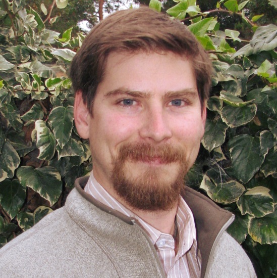
Dr Owen Weller, University of Cambridge, UK
Dr Owen Weller, University of Cambridge, UK
Owen is a Lecturer in structural geology and metamorphic petrology at the Department of Earth Sciences, University of Cambridge. Previously, Owen has held fellowships at the Geological Survey of Canada and the University of Nagoya, and read for a DPhil at the University of Oxford. Owen researches structural and metamorphic processes that occur within the lithosphere, and how these processes have changed over geological time. Owen examines these topics by integrating field and petrographic observations with phase equilibria modelling, thermal modelling, high-temperature geochronology and trace element geochemistry to decode the tectonothermal history of high-grade terranes. Owen is presently interested in the formation and deformation of Archean gneissic terranes, and uses the natural laboratory of Arctic Canada to investigate these processes.
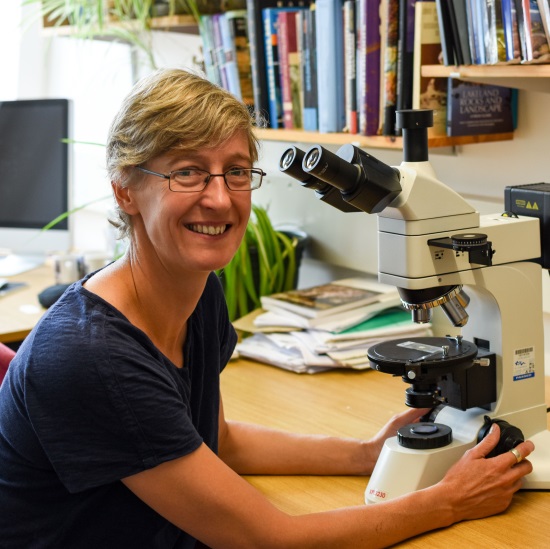
Dr Kristina Dunkel, University of Oslo, Norway
Dr Kristina Dunkel, University of Oslo, Norway
Kristina is a metamorphic petrologist working on the mutual influences of metamorphism and earthquakes. Her particular focus lies in the application of microstructural techniques, especially electron backscatter diffraction (EBSD), to natural samples in order to understand the nucleation of earthquakes, their progress, and their effect on the surrounding rocks.
Kristina obtained her BSc and MSc in Earth Sciences from the University of Münster in Germany. Now, she is part of the interdisciplinary research group PGP (Physics of Geological Processes) at the University of Oslo, where she got her PhD in 2017 as part of the Marie Curie ITN Abyss. In her current position as a postdoctoral fellow, she is responsible for the EBSD facility at the Department of Geosciences in Oslo in addition to her own research.
| 13:30 - 14:00 |
Rheological heterogeneities on the deep subduction interface, and possible relationships to episodic tremor and slow slip
Episodic tremor and slow slip (ETS) is observed in several subduction zones down-dip of the locked megathrust, and may provide clues for preparatory processes before megathrust rupture. Exhumed rocks provide a unique opportunity to evaluate the sources of rheological heterogeneity on the subduction interface and their potential role in generating ETS-like behaviour. Data is presented from two subduction interface shear zones representative of the down-dip extent of the subduction megathrust: the Condrey Mountain Schist (CMS) in northern CA (greenschist to blueschist facies conditions) and the Cycladic Blueschist Unit (CBU) on Syros Island, Greece (blueschist to eclogite facies). Both complexes highlight the propensity for fluid-mediated metamorphic reactions to produce strong rheological heterogeneities. In the CMW, hydration reactions led to partial serpentinization of peridotite bodies and development of highly localized strain on their margins and distributed frictional-viscous deformation in their interiors. In the CBU, dehydration reactions in MORB-affinity basalts led to progressive development of strong eclogitic lenses within a weaker blueschist and metasedimentary matrix. Brittle deformation in the eclogites is coeval with ductile deformation in the surrounding blueschist and metasedimentary matrix, indicating concurrent frictional-viscous flow. Although transient deformation processes cannot easily be distinguished in exhumed rocks, three approaches (scaling analysis, comparison to experiments, and numerical modelling) are used to assess whether these heterogeneities could have generated deformation behaviours similar to deep ETS. All three approaches suggest that frictional-viscous heterogeneities of the types and length-scales observed in the exhumed rock record are compatible with ETS as documented in modern subduction zones. 
Dr Whitney Behr, ETH Zürich, Switzerland
Dr Whitney Behr, ETH Zürich, SwitzerlandWhitney Behr has been Associate Professor and Chair of the Structural Geology & Tectonics Group in the Geological Institute at ETH Zürich since summer 2018. Whitney completed her Bachelor’s degree at California State University Northridge in 2006 and her PhD at the University of Southern California in Los Angeles in 2011. She then spent 11 months at Brown University as a Postdoctoral Fellow in the Geophysics Research group. Prior to arriving at ETH, from 2012–2018, Whitney was an Assistant Professor in the Jackson School of Geosciences at the University of Texas at Austin. Whitney’s research focuses on the rapidly deforming zones that define Earth’s tectonic plate boundaries and generate many of the planet’s geohazards. Her group is interested in the rates and directions in which faults and shear zones move; their geometries, widths and mechanical behaviours at depth; and the processes that shape them over geologic time. |
|
|---|---|---|
| 14:00 - 14:15 | Discussion | |
| 14:15 - 14:45 |
Brittle-viscous deformation cycles and earthquake nucleation in the lower crust
The deformation of the dry lower continental crust is commonly characterized by a cyclic interplay between viscous creep (mylonitisation) and brittle, seismic slip associated with the formation of pseudotachylytes. Seismic slip may trigger fluid infiltration, weakening, and a transition to viscous creep along faults initially characterized by frictional melting. The cyclical interplay between seismic slip and viscous creep implies transient oscillations in stress and strain rate during the activity of faults and shear zones steered by the earthquake cycle. This talk will discuss (i) the ability of shear zone microstructure to preserve evidence of transient high strain rate creep, and (ii) models for earthquake generation in the lower crust. Results from the study of exhumed networks of lower crustal mylonites and pseudotachylytes from different localities will be presented, with a focus on Nusfjord (Lofoten, Norway). In Nusfjord, granulite facies ductile shear zones dissect an anorthosite intrusion. The shear zones localize on precursor pseudotachylytes and developed at ca 700°C and 0.8 GPa. Mylonitised pseudotachylytes locally preserve microstructures (ie layers of fine grained, ca 10 μm, dynamically recrystallized quartz) suggestive of transient high strain rate deformation that are interpreted as episodes of accelerated post-seismic creep. The shear zones occur in three main sets of parallel structures that separate undeformed blocks of anorthosite, within which pristine (non mylonitised) pseudotachylyte fault veins link adjacent or intersecting shear zones. These pristine pseudotachylytes represent direct identification of transient earthquake nucleation as a consequence of local stress amplification during ongoing aseismic creep in ductile shear zones. 
Dr Luca Menegon, University of Oslo, Norway
Dr Luca Menegon, University of Oslo, NorwayLuca Menegon is Associate Professor of Structural Geology and Tectonics at the University of Plymouth, UK, and Associate Professor of Deformation and Metamorphism at the University of Oslo, Norway. Luca’s academic roots are in structural and metamorphic geology. After completing a PhD in structural geology at the University of Padua, Italy (2006), he has been postdoctoral researcher at the University of Padua (2006–2009), at the University of Stockholm (2008) and at the University of Tromsø, Norway (2009–2012). In 2013 he joined the University of Plymouth, and in 2019 he joined the University of Oslo. Luca’s research investigates the brittle deformation and the viscous flow of rocks in the Earth’s interior, which controls the formation of tectonic plate boundaries and the dynamics of the deepest portions of earthquake-generating faults. The relationships between fluid-rock interaction, metamorphism, deformation processes and rock rheology represent a core theme of his current research, which is motivated by the interest in understanding how grain-scale deformation mechanisms control lithosphere dynamics and the earthquake cycle. https://www.plymouth.ac.uk/staff/luca-menegon |
|
| 14:45 - 15:00 | Discussion | |
| 15:00 - 15:30 | Tea | |
| 15:30 - 16:00 |
Modelling metamorphic processes in the Earth’s crust
Much of the Earth’s crust is composed of metamorphic rocks that have experienced ancient orogenesis. During these orogenic events the rocks likely underwent continuous progressive metamorphism, with the presence of H2O-CO2 fluid or silicate melt inferred. However, as both fluid and silicate melt are mobile phases, they can leave the source rocks resulting in a distinct asymmetry to metamorphism. This asymmetry results in relatively dry metamorphic rocks. Such rocks are able to experience subsequent tectonic activity, but are likely to behave differently during any subsequent event. In particular, such dry rocks show a greater tendency to undergo deformation and metamorphism along discrete shear and fault zone structures which may be linked to seismic activity, with surrounding rocks resisting deformation and metamorphism and preserving the earlier metamorphic assemblages. This subsequent metamorphism also occurs over short, discrete timescales resulting in a non-progressive metamorphic reworking. A consequence of reworking under fluid/melt-absent conditions is the existence of typically high-temperature anhydrous minerals at conditions well below where they occur in fluid/melt-bearing systems, making the extraction of P–T conditions of formation difficult. Thus, the high-temperature, open system metamorphic processes that typify the first metamorphic event predispose the rocks to more brittle behaviour in subsequent metamorphic events. 
Professor Richard White, University of St Andrews, UK
Professor Richard White, University of St Andrews, UKProfessor White currently works at the University of St Andrews having been previously employed at the University of Mainz in Germany and the University of Melbourne in Australia. Professor White’s main interests are in constraining how metamorphic processes operate and shape the Earth’s crust during continental plate collision. He develops and applies thermodynamic models for minerals to predict the stability of different phases at elevated pressure and temperature, with a particular interest in high-temperature open system processes such as devolatilisation or melting. He has worked on rocks spanning geological time in areas ranging from Antarctica to northern Scotland. He is currently involved in several projects aimed at better integrating thermodynamic and geodynamic simulations. |
|
| 16:00 - 16:15 | Discussion | |
| 16:15 - 18:00 | Poster Session |
Chair
Dr Luca Menegon, University of Oslo, Norway
Dr Luca Menegon, University of Oslo, Norway
Luca Menegon is Associate Professor of Structural Geology and Tectonics at the University of Plymouth, UK, and Associate Professor of Deformation and Metamorphism at the University of Oslo, Norway. Luca’s academic roots are in structural and metamorphic geology. After completing a PhD in structural geology at the University of Padua, Italy (2006), he has been postdoctoral researcher at the University of Padua (2006–2009), at the University of Stockholm (2008) and at the University of Tromsø, Norway (2009–2012). In 2013 he joined the University of Plymouth, and in 2019 he joined the University of Oslo.
Luca’s research investigates the brittle deformation and the viscous flow of rocks in the Earth’s interior, which controls the formation of tectonic plate boundaries and the dynamics of the deepest portions of earthquake-generating faults. The relationships between fluid-rock interaction, metamorphism, deformation processes and rock rheology represent a core theme of his current research, which is motivated by the interest in understanding how grain-scale deformation mechanisms control lithosphere dynamics and the earthquake cycle.
https://www.plymouth.ac.uk/staff/luca-menegon
Dr Clare Warren, The Open University, UK
Dr Clare Warren, The Open University, UK
Dr Warren, a senior lecturer at the Open University, carries out research into the temporal evolution of deeply buried rocks, in particular concentrating on determining how and when they record the timing of their burial and exhumation, and constraining burial, transformation and exhumation processes and mechanisms. The results have implications for determining how chemical elements (particularly those of economic importance) mobilise, concentrate and/or disperse during crustal recycling.
| 09:00 - 09:30 |
On how tectonics affects seismicity

Dr Ylona van Dinther, Utrecht University, The Netherlands
Dr Ylona van Dinther, Utrecht University, The NetherlandsYlona van Dinther is Assistant Professor at Utrecht University since 2018. She obtained her PhD in 2014 at ETH Zurich by developing numerical models that for the first time start to bridge long-term tectonic and short-term seismicity time scales. Subsequently, for almost five years she lead the Earthquake Physics group at ETH Zurich. With 6 PhD and 4 MSc students they further developed the seismo-thermo-mechanical framework to eg, also resolve dynamic earthquake ruptures and applied it to different tectonic settings. Her research also quantitively combines models with observations through ensemble data assimilation. Ylona received the 2018 AGU Tectonophysics Early Career Award in recognition of this pioneering work. |
|
|---|---|---|
| 09:30 - 09:45 | Discussion | |
| 09:45 - 10:15 |
Insights into the stress state at the deepest extent of major fault zones
Dr Lars Hansen, University of Oxford, UK
Dr Lars Hansen, University of Oxford, UKLars Hansen leads the Rock and Mineral Physics Lab in the Department of Earth Sciences at the University of Minnesota. His research program uses laboratory-based experiments to learn about the manner in which rocks deform, with interests in a wide range of problems that relate the mechanisms of deformation at the atomic scale to the dynamics of the solid Earth at the scale of lithospheric plates. Much of his research focuses on the interactions between microstructure and high-temperature deformation of mantle and crustal rocks. He also uses field-based experiments to analyse the mechanics of past deformation events and to test extrapolations of laboratory-derived models. |
|
| 10:15 - 10:30 | Discussion | |
| 10:30 - 11:00 | Coffee | |
| 11:00 - 11:30 |
Experimental constraints on the rheological properties of the lithosphere at the base of the seismogenic zone
A combination of laboratory, geologic and geophysical observations provides several independent constraints on the rheological properties of the lithosphere. However, several persistent challenges remain in the interpretation of these data. Problems related to extrapolation in both scale and time (rate) need to be addressed to apply laboratory data. Nonetheless, good agreement between extrapolation of flow laws and the interpretation of microstructures in viscously deformed lithospheric mantle rocks demonstrates a strong foundation to build on to explore the role of scale. Furthermore, agreement between the depth distribution of earthquakes and predictions based on extrapolation of high temperature friction relationships provides a basis to understand the links between brittle deformation and stress state. Professor Hirth will outline these and provide thoughts on where new progress can be made to resolve remaining inconsistencies, including discussion of the role of the distribution of volatiles and alteration on the strength of the lithosphere, and links between the location of earthquakes, thermal structure, and stress state. In this context, the group have been exploring the role of fluids on the processes responsible for the brittle-ductile transition in quartz-rich rocks at experimental conditions where the kinetic competition between microcracking and viscous flow is similar to that expected in the Earth. This analysis of this competition suggests that the effective pressure law for sliding friction does not work as 'effectively' near the brittle-ductile transition (BDT) as it does at shallow conditions. The group are investigating simple physically-motivated contact-scale models that explain these observations. The model also provides a context to investigate how the effective stress law evolves with variations in lithology (through its effects on asperity rheology), tectonic environment, strain rate and the evolution of pore-fluid pressure. 
Professor Greg Hirth, Brown University, USA
Professor Greg Hirth, Brown University, USAGreg Hirth studies experimental rock mechanics, deformation mechanisms and frictional properties in both crustal and mantle lithologies, structural geology, and the application of lab data to geophysical and geological problems. He focuses on the processes that control the mechanical behavior of rocks using optical and electron microscopy in conjunction with theoretical considerations. He received his BS from Indiana University, and PhD from Brown University working on the experimental deformation of quartz aggregates. After two years as a Postdoctoral Researcher at the University of Minnesota, he spent 14 years as a Research Scientist at the Woods Hole Oceanographic Institution. He returned to Brown as a Professor in 2007. He is a Fellow of the Mineralogical Society of America and the American Geophysical Union |
|
| 11:30 - 11:45 | Discussion | |
| 11:45 - 12:15 |
Is complex fault zone behaviour a reflection of rheological heterogeneity?
Geophysically constrained fault slip speeds range from steady plate boundary creep through to earthquake slip. Geological observations show that faults accommodate slip by modes ranging from localised slip on one or more discrete failure planes, through to shearing flow distributed within a tabular zone of finite thickness, indicating a large range of possible strain rates in natural faults. Crosscutting relations between brittle and ductile structures demonstrate that strain rate can change both progressively and cyclically within a single fault zone. Both geological observations and numerical models have now shown that such temporal strain rate variations may arise from rheological heterogeneity in space. If fault slip style is related to fault zone heterogeneity, then there must be certain conditions that produce earthquakes, creep, and intermediate velocities. Because these slip styles occur over large ranges in temperature, the controlling conditions must be affected by more than temperature alone. Dr Fagereng suggests that the strength ratio between relatively competent materials and their failure criteria, as well as the viscosity ratio of shear zone components, are important controls. Consequently, he proposes a preliminary model for the bulk behaviour of a mixed material shear zone. 
Dr Åke Fagereng, Cardiff University, UK
Dr Åke Fagereng, Cardiff University, UKÅke Fagereng received his PhD in geology from Otago University, New Zealand, in 2010. He went on to a position as Lecturer and then Senior Lecturer at the University of Cape Town, South Africa, before moving to Cardiff University in 2014, where he is currently a Reader in Structural Geology. His research focuses on structure and rheology of faults and shear zones, and correlations between geological and geophysical observations of fault slip style. He holds a prestigious ERC Starting Grant, and also receives funding from the UK Global Challenges Research Fund. He was awarded the South African National Research Foundation’s President’s Award in 2013, and the Outstanding Young Scientist Award of the EGU Tectonics and Structural Geology Division in 2016. He is an Associate Editor for Geophysical Research Letters and edited a book, Geology of the Earthquake Source, for the Geological Society of London. Åke has published over 50 papers in international, peer-reviewed journals, including in Nature Geoscience, Geology, EPSL, and Geophysical Research Letters. |
|
| 12:15 - 12:30 | Discussion |
Chair
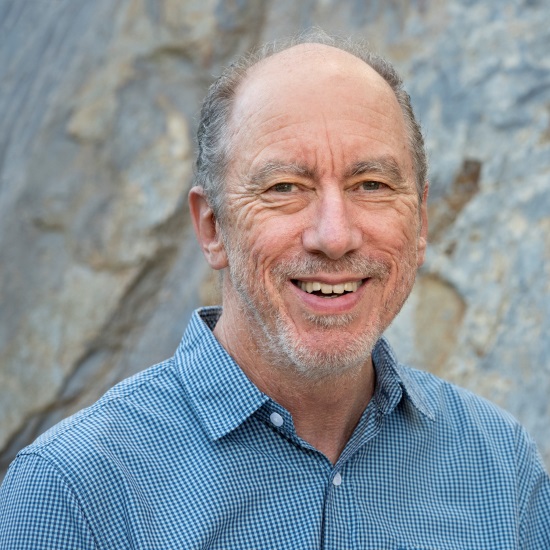
Professor Peter Cawood, Monash University, Australia
Professor Peter Cawood, Monash University, Australia
Peter Cawood’s research is focused on the origin of the Earth’s continental lithosphere (crust and upper mantle) and the processes of its generation, stabilization and reworking. He integrates direct field observations with leading laboratory techniques, and has worked in regions from Archean (> 2500 million years) cratons to modern and active margins, and at scales ranging from global to microscopic. His work aims to resolve the processes involved in lithosphere formation and the feedbacks with the rest of the Earth system. Peter obtained undergraduate and PhD degrees from the University of Sydney and has held academic positions in Australia, New Zealand, Canada, and the UK. He is currently Australian Research Council Laureate Fellow at Monash University, Australia.
Dr Whitney Behr, ETH Zürich, Switzerland
Dr Whitney Behr, ETH Zürich, Switzerland
Whitney Behr has been Associate Professor and Chair of the Structural Geology & Tectonics Group in the Geological Institute at ETH Zürich since summer 2018. Whitney completed her Bachelor’s degree at California State University Northridge in 2006 and her PhD at the University of Southern California in Los Angeles in 2011. She then spent 11 months at Brown University as a Postdoctoral Fellow in the Geophysics Research group. Prior to arriving at ETH, from 2012–2018, Whitney was an Assistant Professor in the Jackson School of Geosciences at the University of Texas at Austin. Whitney’s research focuses on the rapidly deforming zones that define Earth’s tectonic plate boundaries and generate many of the planet’s geohazards. Her group is interested in the rates and directions in which faults and shear zones move; their geometries, widths and mechanical behaviours at depth; and the processes that shape them over geologic time.
| 13:30 - 14:00 |
Impact of large-scale faulting and weak lower crust on India-Eurasia deformation inferred from 3-D geodynamic modelling
A key topic of contention involving continental deformation revolves around the relative importance of discrete faulting or distributed strain on the accommodation of observed deformation. Professor Flesch's group uses 3-D, lithospheric, Stokes flow lithospheric simulations of the India-Eurasia (IN-EU) collision zone to investigate the effect of large-scale lithospheric faults on surface deformation and derive allowable bounds for fault strength and spatial scale. Lithospheric strength is constrained by laterally-varying, lithospheric-average effective viscosities and partitioned vertically to capture strength anomalies corresponding to geophysically-imaged slabs and weak Tibetan lower crust. Finite zones of low viscosity are introduced representing major fault systems of the IN-EU collision zone: the Karakorum, Altyn-Tagh, Kunlun, Jinsha Suture-Xianshuihe, Jiali-Red River, and Sagaing. The group finds (1) narrow zones of lithospheric scale weakness in conjunction with a weak lower crust are important for reproducing rotation in Southeast Tibet and (2) cases with finite zones of weakness representing large-scale faults produce focused uplift at the Longmen Shan and extension across southern Tibet and thickening in northeastern Tibet consistent with observations.
Professor Lucy Flesch, Purdue University, USA
Professor Lucy Flesch, Purdue University, USALucy Flesch is a Professor in the Department of Earth, Atmospheric and Planetary Sciences at Purdue University. Her research integrates geodetic, seismic, and geologic observations into geodynamic models to address questions relating to how strain is accommodated across large zones of continental deformation, rheology of the lithosphere, lithospheric coupling, role of gravitational potential energy and the balance of forces responsible for generating observed deformation. Professor Flesch has written papers addressing these questions for the India-Eurasia collision zone, Western United States, Alaska, Africa and South America. Professor Flesch received her PhD in 2002 from Stony Brook University working with Bill Holt. |
|
|---|---|---|
| 14:00 - 14:15 | Discussion | |
| 14:15 - 14:45 |
Microstructural records of earthquakes in the dry lower crust
Both seismic data and the rock record show that earthquakes occur deep in the continental crust, below the standard seismogenic zone. Because of the high confining pressures at depth, seismic slip in the lower crust requires either high stresses, which can only be sustained over short timescales, or the activity of a local weakening mechanism. These generating mechanisms of lower crustal earthquakes are difficult to investigate because the records of such earthquakes, e.g. pseudotachylytes, are typically reacted and/or deformed. This talk will give a brief overview over lower crustal earthquakes in general and some microstructural features that can shed light on their origins, mechanisms and effects. It will then focus on a field and microstructural study from the Lofoten Vesterålen Archipelago, Northern Norway, where exceptionally pristine pseudotachylytes occur in lower crustal granulites. The most commonly invoked weakening mechanisms, such as dehydration embrittlement or thermal runaway, can be excluded here, because the pseudotachylytes and their host rocks are anhydrous and not associated with mylonites. Transient stress pulses caused by shallower earthquakes are the most likely explanation for the occurrence of fossil earthquakes in this case.
Dr Kristina Dunkel, University of Oslo, Norway
Dr Kristina Dunkel, University of Oslo, NorwayKristina is a metamorphic petrologist working on the mutual influences of metamorphism and earthquakes. Her particular focus lies in the application of microstructural techniques, especially electron backscatter diffraction (EBSD), to natural samples in order to understand the nucleation of earthquakes, their progress, and their effect on the surrounding rocks. Kristina obtained her BSc and MSc in Earth Sciences from the University of Münster in Germany. Now, she is part of the interdisciplinary research group PGP (Physics of Geological Processes) at the University of Oslo, where she got her PhD in 2017 as part of the Marie Curie ITN Abyss. In her current position as a postdoctoral fellow, she is responsible for the EBSD facility at the Department of Geosciences in Oslo in addition to her own research. |
|
| 14:45 - 15:00 | Discussion | |
| 15:00 - 15:30 | Tea | |
| 15:30 - 16:00 |
Linking micro-scale processes to macro-scale phenomena
To model present and future continental deformation and to increase our understanding of the location, recurrence and character of earthquakes, an in-depth understanding of the interaction and feedback between brittle and ductile deformation and their respective flow laws is needed. Millimetre to kilometre scale pinch-and-swell structures originate from this interplay of ductile and brittle deformation and are therefore ideally suited to investigate such behaviour. In these geological structures a more competent layer is subject to failure and subsequent ductile flow while the surrounding material is continuously viscously deforming. In addition to insights regarding the link between ductile and brittle behaviour, these structures and their associated microstructures can be used derive relative and if combined with experimentally derived flow laws absolute viscosities of different rock units including highly heterogeneous rocks such as paragneisses and orthogneisses. At the same time, microstructures of upper crustal fault rocks with variable strain history offer the unique opportunity to investigate the temporal changes from brittle to ductile behaviour and vice versa within a fault zone. Numerical models built on insights from such geological structures allow for transient brittle behaviour in different crustal level. As such, these models can be used to predict the character of brittle behaviour in the upper crust. 
Professor Sandra Piazolo, University of Leeds, UK
Professor Sandra Piazolo, University of Leeds, UKSandra Piazolo’s main scientific interest is the understanding of micro- and mesoscale processes and their link to macro-scale phenomena. To achieve this, it is essential to quantify microstructures and thus micro-structural processes active during a variety of P-T-fluid conditions. In addition, the development of new techniques to observe, interpret and evaluate processes in the Earth and under planets is part of my research. Fields of research interest include: (i) rock deformation from small to large, (ii) rheology and deformation mechanisms in rocks and ice (iii) microstructural and-chemical analysis of planetary and extraterrestrial materials, (iv) microdynamic modelling (mainly using the microdynamic modelling platform Elle (http://microstructure.info/)), (v) experimental deformation and heating of rocks and analogue materials i.e. metals, ice, (vi) field mapping of high grade terranes and fault zones. Sandra has relatively recently joint the University of Leeds and has current a major interest in faults and earthquakes and their link to the dynamic feedback between deformation of the crust from deep to shallow. |
|
| 16:00 - 16:15 | Discussion | |
| 16:15 - 17:00 | Panel discussion and future directions |