Geodiversity science for society
Theo Murphy international scientific meeting organised by Dr Franziska Schrodt, Dr Malcolm Hunter, Mr Derk van Ree, Professor W Daniel Kissling, Dr Richard Field and Dr Joseph J Bailey.
Geodiversity, heterogeneity of abiotic nature, is both dynamic and crucial to Earth’s systems. Yet, human-induced change threatens geodiversity globally. This meeting brought together experts across disciplines, strengthened the intellectual core around geodiversity science and enhanced its policy impact by developing ‘essential geodiversity variables’, related to human well-being, sustainability and natural resource management. This will initiate a new field of transdisciplinary science.
The schedule of talks and speaker biographies and abstracts can be found below.
The meeting papers are available in Philosophical Transactions of the Royal Society A.
Attending this event
This event has taken place.
Enquiries: contact the Scientific Programmes team
Organisers
Schedule
| 09:05-09:25 |
Geodiversity: redundant term or significant, multi-faceted and evolving geoscientific concept
This presentation will outline ten geodiversity-related topics and will argue that geodiversity has contributed to many new insights, new avenues of research and new results. The ten topics are: Celebrating, Assessment and Measurement, Geosystem Services, Biodiversity, Geomaterials, Geotourism and Leisure, Geoheritage, National Geoconservation, World Heritage Sites and Global Geoparks, and Sustainability. It will be concluded that geodiversity is a) a global as well as a regional/local concept, b) more than just related to biodiversity, important though this is, and c) absolutely central to any relationship between the ‘Gs’ (Geoheritage, Geoconservation, Geotourism, etc.) It will therefore be argued that geodiversity is not ‘a redundant term’ as recently suggested but instead is a significant, multi-faceted and evolving geoscientific concept. 
Professor Murray Gray, Queen Mary University London, UK
Professor Murray Gray, Queen Mary University London, UKMurray Gray is Honorary Professor at Queen Mary University of London and Visiting Professor in the School of Earth Sciences, University of Minho, Portugal. He trained as a glacial geomorphologist at the University of Edinburgh but subsequently developed an interest in geodiversity and geoconservation. He is author of two editions of the book 'Geodiversity: valuing and conserving abiotic nature' (Wiley-Blackwell, 2004 & 2013) and many papers and book chapters promoting the geodiversity concept. He is a Fellow of the Geological Society of London and a Member of the IUCN-WCPA Geoheritage Specialist Group. In 2022 he was awarded a Special Award by the UK's Geologists' Association for his work on geodiversity and towards achieving UNESCO's proclamation of International Geodiversity Day on 6 October each year. |
|---|---|
| 09:25-09:30 |
Discussion
|
| 09:30-09:55 |
Geodiversity for biodiversity and conservation
Joseph’s talk will briefly summarise some of the reasons geodiversity matters for biodiversity and, therefore, its practical and policy role for the conservation of biodiversity. The potential for geosites and geoparks in current nature conservation targets will then be discussed. In particular, ‘other effective areas-based conservation measures’ (OECMs) will be considered in the context of the ‘30x30’ (30% protected areas by 2030) target, which over 100 countries have signed up to and was a key area of discussion at COP 15 in Montreal (Dec 2022). Geodiversity, and its associated conservation designations, have thus far been under-considered in terms of their potential contribution to effective nature conservation targets globally. Essential Geodiversity Variables (EGVs) could help identify areas for conservation across scales. |
| 09:55-10:00 |
Discussion
|
| 10:00-10:25 |
Back to the basics: classification and taxonomy of geodiversity
Geodiversity research is a rapidly developing field in earth and environmental sciences. In addition to the basic research, geodiversity information is needed in nature conservation, to explore ecosystem services, and to achieve sustainable development goals. Eventually, geodiversity contributes to human health and well-being. Despite the rising need for geodiversity information, there exist few comprehensive categorization systems of abiotic nature to be used in observing geodiversity. The aim of the talk is to raise the need for a taxonomy of geodiversity and present a tentative classification system for the elements of geodiversity (ie geofeatures). In the presented taxonomy, the main components of geodiversity are geology, geomorphology, soil and hydrology. The components and elements of geodiversity are classified at lower taxonomic levels based on their genesis, physical-chemical properties, and morphology. The lowest taxonomic level is assumed to contain tens of thousands of specific geofeatures. Consequently, further development of the hierarchical system requires multidisciplinary collaboration between (geo)scientists. A comprehensive taxonomy could be used to map and quantify geodiversity for numerous basic and applied purposes. |
| 10:25-10:30 |
Discussion
|
| 10:30-11:00 |
Break
|
| 11:00-11:25 |
Geodiversity and geological history in the Andes-Amazon System
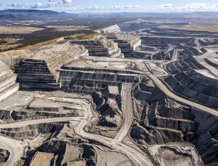
The Amazon hosts the most diverse tropical forest on Earth. But underneath, the Amazon also comprises an exceptionally geodiverse landscape, marked by the towering Andes in the west, highland plateaus with dramatic escarpments in the east, and the Amazon River traversing the region as a major artery. The subdivision of the Amazon into craton versus Andes-influenced landscapes and soils are the result of a unique geologic history determined by the interplay of plate tectonics, climate, dynamic topography, and sea level change that played out over billions of years. Together these factors created an exceptionally high geodiversity and diverse hydrological landscape. Amazonian geodiversity arises from the heterogeneous distribution of lithologies in the geological substrate and edaphic (soil) conditions at many spatial scales, under the perennial influence of varied hydrological and biological process, at the surface and subsurface. It took hundreds of millions of years for the Amazon to develop the rich tapestry of landforms, soils, and ecosystems we see today, but humans degrade these unique ecosystems at a much faster rate. Decisions should be made to avoid further degradation and consider the time necessary for the Amazon to recover, which, if at all, will not be on a human-relevant timescale. For reference see: Geology and geodiversity of the Amazon: Three billion years of history Pedro Val, Jorge Figueiredo, Gustavo de Melo, Suzette G.A. Flantua, Carlos Alberto Quesada, Ying Fan, James S. Albert, Juan Manuel Guayasamin, Carina Hoorn, 2021. In Science Panel for the Amazon: Assessment Report, Chapter 1. |
| 11:25-11:30 |
Discussion
|
| 11:30-11:55 |
Online: Geoconservation as a tool for ecosystem protection and local economic development
The relationship between geodiversity and biodiversity reflects the interaction between the living and the sub-stratum geology. This close relationship cannot be ignored when studying, protecting, and valorising ecosystems. Acquiring a basic knowledge of geological formations and features and prioritizing the protection of natural resources as essential assets, help mainstream the consideration of such dependencies in local economic development. The geodiversity of an area is a combination of components covering the base formations’ physical, chemical, and morphological features. Relevant elements shaping biodiversity and ecosystems include soil, lithology with specific elements and nutrients in the rocks, altitude, relief, exposure, karst, cracks, faults, etc. The geomorphology of Lebanon with its stratigraphy and abundant karstic formations gave spectacular landscape and remarkable natural beauty, and offered specific habitat for a flourishing ecosystem, some of its flora and fauna endemic. From main bird migration corridors to lush riparian environments, rocky habitat for bats, and rich palaeontology, Lebanon offers the natural elements and opportunities for environmentally friendly development in ecotourism. Such development is supplemented by significant potential in harnessing geological elements to benefit an agricultural sector that ensures livelihood and resilience to local communities. Bats and birds within the Afqa resurgences and Baatara gorge waterfall (three bridges), association of umbrella pine forests with the silica sandstones formations, endemic Orchid species within basaltic outcrops, majestic oaks and cedars in white limestones and dolomites, resilient fig orchards and vineyards in marly iron and sulphur-rich limestones within traditional terraces are examples to build on. A proper vision for valorising geodiversity as key in sustainable development is needed. Such vision would be complemented by an effective strategy on how to protect vulnerable geosites, accounting for private land tenure, and encompassing main-streaming geo-education, and conducting awareness raising and advocacy campaigns. |
| 11:55-12:00 |
Discussion
|
| 12:00-12:30 |
Session 1 discussion
|
| 12:30-13:30 |
Lunch
|
| 13:30-13:55 |
Geomorphological perspectives on geodiversity: process dynamics, essential variables, and the biotic-abiotic interface
Along with geology, soils and hydrology, geomorphology is recognised as a key component of geodiversity. Professor Viles focuses on two ways in which the discipline of geomorphology can contribute to the ongoing development of geodiversity science theory and practice. First, under the ‘essential variables’ (EVs) framework, she shows how in the context of particular geosystems, geomorphological understanding of process-form relationships helps identify those EVs driving the formation, distribution, and dynamics of landforms at the Earth’s surface. Moreover, using a range of geohazards as examples, she suggests that a systems-based approach helps reveal ‘sensitive variables’ that, in the context of environmental change and disturbance, might constitute policy-relevant EVs. Second, Professor Viles highlights the importance of specifically bio-geomorphological processes and outcomes for generating geodiversity at a range of spatial and temporal scales, which have largely been overlooked in current framings of geodiversity. Positioned at the interface of life and landscape, she suggests that biogeomorphology provides an important link between geodiversity and biodiversity EVs. Moreover, she stresses how biogenic components of geodiversity (‘biogenic landforms’), such as coral reefs and coastal wetlands, underpin a range of policy-relevant ecosystem services that can support the delivery of nature-based solutions in the face of global environmental challenges. |
|---|---|
| 13:55-14:00 |
Discussion
|
| 14:00-14:25 |
Mapping geodiversity: from local to global scales
Geodiversity inventories are essential to help protect irreversible loss of valuable earth scientific information and cultural heritage. Recent initiatives to map geodiversity include a range of descriptive to fully automated and index-based methods that include spatial analyses of local, national or global datasets at different scales and varying quality. Harmonization of these geological, geomorphological, pedological and hydrological input datasets is necessary to effectively study for example temporal changes in geodiversity, to link geodiversity and biodiversity and to integrate geodiversity in conservation and management studies across scales. To showcase scale effects, local and national scale geodiversity index maps (from Vorarlberg-Austria, the Netherlands, Ecuador and the Hawaiian archipelago) are compared to a global, harmonized geodiversity index map. In addition, the global index-based geodiversity inventory is used to evaluate the representativeness of global geodiversity in UNESCO Global Geoparks by statistically comparing geodiversity components inside and outside the parks. The results indicate that geological and topographical diversity is well-represented, but soil and hydrological diversity are underrepresented. It is possible that the outcome is related to the uneven spread of the geoparks across the globe and/or to the application criteria used to establish a UNESCO Global Geopark. |
| 14:25-14:30 |
Discussion
|
| 14:30-15:00 |
Break
|
| 15:00-15:25 |
Online: Can geodiversity improve models of biodiversity and species’ distributions?
Biodiversity and climate change are inextricably linked yet forecasting biodiversity responses to climate change remains a challenge. Improving biodiversity forecasts requires robust models of species’ distributions. Species distribution models often rely solely on environmental variable means as predictors at single resolutions, yet species are also distributed in relation to environmental heterogeneity, and these relationships are scale-dependent. One approach to capture spatial heterogeneity in the environment is to incorporate scale-dependent measures of geodiversity with the R package ‘geodiv’. This research tests the ability of geodiv-derived geodiversity measures to improve species distribution and biodiversity models at varying spatial scales. Two cases are considered: plant and animal biodiversity within the US National Ecological Observatory Network (NEON); and bird and mammal frugivore species distributions within Neotropical montane biodiversity hotspots. Initial results show that certain measures and scales of geodiversity improve models of biodiversity and species distributions, and these measures and scales tend to be taxon-specific. Trait-based analysis is likely to improve the selection of geodiversity measures and scales in practice, resulting in more robust models explaining and predicting biodiversity responses to current and future climate change. |
| 15:25-15:30 |
Discussion
|
| 15:30-15:55 |
Essential geodiversity measures for investing in a nature-positive future?
Of the four Goals of the Kunming-Montreal Global Biodiversity Framework (GBF), Goal A focuses on improving the integrity, connectivity and resilience of all ecosystems, and Goal B focuses on enhancing nature’s contributions to people. Target 19 is to mobilize at least US$200 billion per year for such purposes, by 2030. In this talk I first discuss the recent explosion of interest in private investment in nature and the need for scientific expertise to underpin the developing markets. This is in addition to widespread regulatory ‘nature positive’ approaches. A major focus is the need to measure biodiversity and ecosystem services, and any changes in them at appropriate spatial and temporal scales. I then ask how geodiversity can fit into these initiatives. Should geodiversity itself be a key target for nature-positive initiatives? To what extent should we aim to use appropriate measures of geodiversity as part of measuring the impacts of projects on biodiversity (leading on from Conserving Nature’s Stage ideas)? Now is the right time to address such questions. |
| 15:55-16:00 |
Discussion
|
| 16:00-16:25 |
EcoSystem Integrity – Sensor /EO-Service (ESIS) for monitoring bio- and geodiversity by spectral traits and remote sensing approaches
Ecosystems fulfil a whole range of ecosystem functions. There are a variety of long-standing and standardised approaches to monitoring ecosystem health, bio- and geodiversity that increasingly integrate RS-based monitoring approaches. Unfortunately, these approaches to monitoring, data storage, analysis, forecasting and assessment do not yet meet the future demands of 21st century information and digital knowledge processing. If we are to understand the complexity of our system, we need to adopt a holistic RS monitoring approach. Traits and trait variations exist at all spatio-temporal scales. Traits are the crucial interface between different ecosystem domains, linking in situ and RS monitoring approaches, and are proxy indicators of ecosystem-human health interactions. RS traits can be used to quantify genesis, structural, functional and taxonomic geo- and biodiversity, vegetation health and land use intensity indicators. In this presentation Dr Lausch presents the development of an ‘EcoSystem Integrity - RS/Modelling Service (ESIS)’ tool. |
| 16:25-16:30 |
Discussion
|
| 16:30-16:45 |
Session 2 discussion
|
| 16:45-17:00 |
Poster speed talks
|
| 17:00-18:30 |
Poster session
|
| 18:30-19:30 |
Dinner
|
| 12:05-12:30 |
Discussion
|
|---|---|
| 09:00-09:25 |
The geodiversity strategy of the regional government of the Basque Country
The Basque Country is an autonomous region located in the north-east of Spain and presents a high geodiversity index and international significant geoheritage. There are 150 geosites inventoried in this part of the planet. The managers of this territory, considering nature management in a holistic way, have designed a consensual geoconservation strategy for the whole country. This strategy tries to reach an agreement between administrations and citizenship and arranging objectives and actions to achieve a correct management of the Basque geosites. This lecture aims to explain how, from local management, it is possible to implement a coordinated and effective policy in relation to geoheritage conservation and management.
Dr. Manu Monge-Ganuzas, Natural heritage and Climate Change Directorate. Economic Development, Sustainability and Environment Department, Basque Government, Spain
Dr. Manu Monge-Ganuzas, Natural heritage and Climate Change Directorate. Economic Development, Sustainability and Environment Department, Basque Government, SpainManu Monge Ganuzas is Doctor in Geology (University of the Basque Country (UPV/EHU), 2008). He has worked as an Environmental Technician for more than 20 years in the Regional Government of the Basque Country (Spain). He is currently the president of the Geoheritage Commission of the Geological Society of Spain and the coordinator the Southwestern Europe Regional Group of ProGEO, the International Association for the Conservation of Geological Heritage. He is also member of the Group of Experts on Protected Areas and Geoheritage of the International Union for Conservation of Nature (IUCN). |
| 09:25-09:30 |
Discussion
|
| 09:30-09:55 |
Policy context: England’s geodiversity, where we’re coming from and where we may be going
England is among the most geologically diverse places in the world. It was recognition of this ‘geodiversity’, and its defining place in the global science of geology, that inspired the inclusion of geology as a keystone in post-war planning and conservation legislation – the 1949 National Parks and Access to the Countryside Act. From this moment to the present day this paper reviews and reflects on the success and challenges in the application of this legislation for geodiversity. In particular the development of a network of protected sites is considered including Sites of Special Scientific Interest and National Nature Reserves, and more recently UNESCO World Heritage Sites and Global Geoparks. We have potentially reached a moment of new opportunity as increasingly the importance of integrating geodiversity and biodiversity in the way we understand, utilise and manage the natural world is being better realised. A new ambition for National Nature Reserves to develop the geological story they tell, and a shared approach to Nature Recovery that enhances protected sites, improves landscape resilience, reinforces landscape diversity, and connects people with nature, offers new opportunities for geodiversity. |
| 09:55-10:00 |
Discussion
|
| 10:00-10:25 |
Sustainable development of the subsurface and the urban environment: geosystem services as the link to human wellbeing
Because the functions of the subsurface are hidden from view, its important role in society is often ignored or taken for granted. It is however an essential part of the global ecosystem with important contributions to human well-being. Recognizing contributions stemming from geodiversity of the earth’s ecosystem in ensuring sustainability requires a balance between exploitation and protection. 
Mr Derk van Ree, Deltares, The Netherlands
Mr Derk van Ree, Deltares, The NetherlandsDerk van Ree is an expert on the role of the subsurface for society. He is a specialist in multidisciplinary environmental analysis for infrastructure projects including soil and groundwater modelling and monitoring of effects and risks to existing infrastructure and buildings. He has executed many field studies performing subsurface site characterizations for environmental and geohydrological studies. In this field he performed research on the development and application of in situ site characterization technologies focusing on push in technologies including the application of on-site physico-chemical sensors. He participated in European research framework programs such as FP5, 6 and 7 and Horizon2020 for example on environmental technology verification. He acts as expert member of the Dutch National Committee for Environmental Impact Assessment for projects focused on subsurface aspects, eg spatial development plans, mining construction minerals, and siting waste disposal sites. |
| 10:25-10:30 |
Discussion
|
| 10:30-11:00 |
Break
|
| 11:00-11:45 |
Engaging policy makers and the public: Lessons from an award winning, BAFTA nominated nature documentary producer and director
Why is it so important to engage the general public in matters concerning geodiversity? And what is the best way to do it? Over the last 25 years, the television landscape has changed, from terrestrial television broadcasts, to streaming, online, and on demand. As documentary filmmakers, we have adapted and are still adapting to this new and still evolving televisual topography, but what lessons have we learnt about engaging with the public? Mr Olding explores the changes in narrative content and the way information is presented in factual documentaries, the use of CGI and VFX to aid in scientific explanations, expanding ambitions (and budgets) to give wider global perspectives and the role of audience engagement that sits at the heart of the best documentaries. He also explores why geodiversity is still so important to bring to a wide audience, to keep expanding people's knowledge horizons, to help the public see connections and connectivity across a global landscape, to understand the fragility of our pale blue dot, and of course, to inspire, educate and entertain. 
Dr Paul Olding, Filmmaker, UK
Dr Paul Olding, Filmmaker, UKDr Paul Olding is a BAFTA nominated, multi-award winning TV Writer/Director and Producer. He has made over 50 TV films, travelling the globe to document and explore the natural world and ancient civilisations. Paul has worked with the likes of Professor Brian Cox, Professor Iain Stewart and Professor Alice Roberts in making ground breaking and innovative science and history documentaries shown around the globe. Paul has a doctorate in the calls of Australian Microhylid treefrogs from the University of Oxford and was once the World’s second leading expert in these small but vocal frogs. He also owns and manages a boutique commercial vineyard located in East Sussex called Wildwood Vineyard. He is the author of two books The Urban Vineyard and Return to the Berber Village. |
| 11:45-12:00 |
Questions
|
| 12:00-12:25 |
Plenary discussion – How can we better integrate geodiversity with policy and society?
|
| 12:30-13:30 |
Lunch
|
Chair
John Gordon, University of St Andrews, UK
John Gordon, University of St Andrews, UK
John Gordon is an Honorary Professor in the School of Geography and Sustainable Development at the University of St Andrews, Scotland. He is a geomorphologist and before retiring worked in geoconservation for many years with the statutory nature conservation agencies in Great Britain, advising on the assessment, documentation and conservation management of protected areas for geoheritage. He is a member of the Steering Committee of the Geoheritage Specialist Group of the IUCN World Commission on Protected Areas. As well as geoconservation, his interests include glaciers and mountain geomorphology. He has published widely on these topics, and is co-author/editor of Quaternary of Scotland Geological Conservation Review (1993), Soils, Sustainability and the Natural Heritage (1996), Antarctic Environments and Resources: A Geographical Perspective (1998), Earth Science and the Natural Heritage (2001), Advances in Scottish Quaternary Studies (2019), Guidelines for Geoconservation in Protected and Conserved Areas (2020) and Landscapes and Landforms of Scotland (2021).
| 13:30-13:55 |
Online: Out of sight, out of mind: The undervaluation of the geodiversity and geosystem services
In an earlier systematic literature review we show that valuation studies on geodiversity and geosystem services in the scientific literature are scarce. This gap stems from exclusion of a number of abiotic goods and services as well as a lack of attention in the current scientific community to this topic. The underrepresentation of value of geodiversity and geosystem services negatively impacts integrated decision making in spatial planning, environmental policy making and long-term ecosystem management. In a more recent literature review, we show how discrete choice experiments are used to value the characteristics of geoparks and natural parks. For “the Famenne Ardenne” UNESCO geopark a discrete choice experiment is being conducted. Using a discrete choice experiment, we aim to elicit the value park visitors attach to the park’s characteristics and which management strategies they would find acceptable to reduce crowding and to explore other parts of the park. In our session, we would like to start a discussion with the other experts whether valuation of geodiversity and geosystem services is critical for its sustainable management. |
|---|---|
| 13:55-14:00 |
Discussion
|
| 14:00-14:25 |
Linking geodiversity variables to biodiversity conservation planning through the Conserving Nature's Stage concept
Although ecologists have understood geodiversity's relevance in shaping the distribution of biodiversity since the early 19th century, conservation planners rarely use geodiversity to prioritize land for conservation. As the impacts of climate change become more intense and uncertain, conservation planners need planning tools to prioritize lands for protection that are less reliant on climate or contemporary biotic distributions. One option, the Conserving Nature's Stage approach, suggests that by identifying sites that collectively span the diverse combinations of the enduring geophysical environments, we may protect the majority of species today and into the future. In this presentation, Dr Miller will present recent results from testing how well sites selected to span geodiversity represent species from 35 biological inventories from around the globe. Dr Miller will also discuss how these results compare to previous tests in methodology and conclusions and explain how methodological choices may influence test outcomes. Dr Miller hopes these results will encourage the use of geodiversity in conservation planning and inspire research on the topic to move beyond proof of concept. 
Dr Stephanie Miller, University of Maine, USA
Dr Stephanie Miller, University of Maine, USADr Stephanie Miller's primary research interest is using modelling techniques to explore the connections between the environment and biodiversity patterns at landscape to regional scales and ultimately to create products that aid decision-making related to conservation and climate change adaptation. Dr Miller completed a PhD in Forest Science under the supervision of Dr Paul Beier in 2021. Dr Miller is now working as a Postdoctoral Research Associate with the University of Maine. Her current research focuses on predicting climate change's impacts on biodiversity and rural communities of the northeast United States to help inform decision-making for adaptation to climate change over the next century. |
| 14:25-14:30 |
Discussion
|
| 14:30-15:00 |
Break
|
| 15:00-15:25 |
Challenges and opportunities – the future of Essential Geodiversity Variables
Essential variables (EVs) are aimed at improving consensus on terminology and identify essential sets of measurements for characterizing and monitoring changes on our planet. Recent years have seen the instigation of new EVs beyond the well-established ones for climate, oceans, biodiversity, including Essential Geodiversity Variables (EGVs). I will provide an overview of the usefulness of EVs and developments in the establishment of and coordination between new EVs. I will define EGVs, give a quick overview of their history and status of development, and outline the next steps needed to ensure successful development and uptake of EGVs across science and policy. |
| 15:25-15:30 |
Discussion
|
| 15:30-16:15 |
Break-out group discussions - Towards a global observing system for geodiversity
|
| 16:15-17:00 |
Plenary discussion - Towards a global observing system for geodiversity
|