Hirra Ateeq maps out the contributions of unsung local surveyors, instrument-makers and mathematicians to the Great Trigonometrical Survey of India.

Following its establishment as an Indian Ocean commodities trading company in 1600, the British East India Company sought to exercise increasing control over the Indian subcontinent, eventually administering and colonising large territories. By the nineteenth century, with more and more newly-colonised land, the Company needed to employ explorers and cartographers to map the region.
 William Lambton (public domain via Wikimedia Commons)
The Great Trigonometrical Survey of India aimed to map the entire Indian subcontinent with scientific precision. Following a proposal from William Lambton FRS, the project began in 1802 with an origin point at Madras Observatory, and a baseline of 7.5 miles was measured. The Survey provided knowledge, enabled control, and enhanced the East India Company’s reputation, which legitimised colonial rule. The act of measuring, quantifying and naming lands is a declaration of ownership.
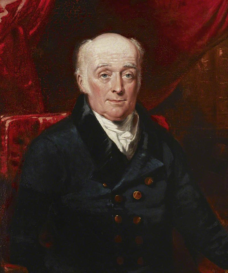
 George Everest FRS RS.7902
In 1823 George Everest became the Survey’s Superintendent. Manuscript MS/234, held in the archives of the Royal Society, is a volume of tables prepared by Everest for the use of the Survey. At the beginning is an 1865 letter from Everest to Edward Sabine (then President of the Royal Society), in which he remarked ‘the tables have never been printed and this and another copy in manuscript which I left as an heirloom when I quitted my post in 1843, are the only records of my labours in that line’. Everest noted his ‘extensive use’ of this book of tables in computing azimuths.
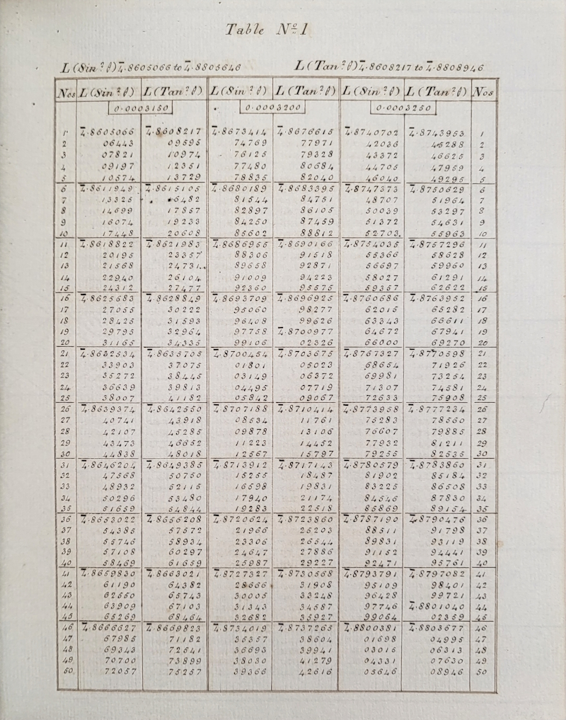 Tables prepared by Sir George Everest for the use of the Great Trigonometrical Survey of India (MS/234)
Everest’s successor Andrew Scott Waugh FRS went on to suggest Everest’s name for the tallest mountain of the Himalayas, and the world. He wrote to Henry Thuillier in March 1856: ‘In the meantime, the privilege, as well as the duty, devolves on me to assign to this lofty pinnacle ... a name whereby it may be known among geographers, and become a household word … I have determined to name this noble peak ... Mont [sic] Everest.’
However not all contributors to the Survey were immortalised, and there are many unsung heroes of this story, in the form of employees from the Indian subcontinent, often referred to as ‘natives’ or ‘pundits’. There was a particular need for local expertise in the case of Tibet, which had closed its borders to foreigners during the nineteenth century, and thus required Indian surveyors who could travel disguised as merchants or traders to carry out trigonometrical observations. Thomas George Montgomerie FRS therefore proposed a plan to train Indian explorers to survey the land and fill in the blanks on the map of Tibet and Central Asia. This formed part of what was known as ‘The Great Game’, a rivalry between the British and Russian empires using spies to influence this part of the world.
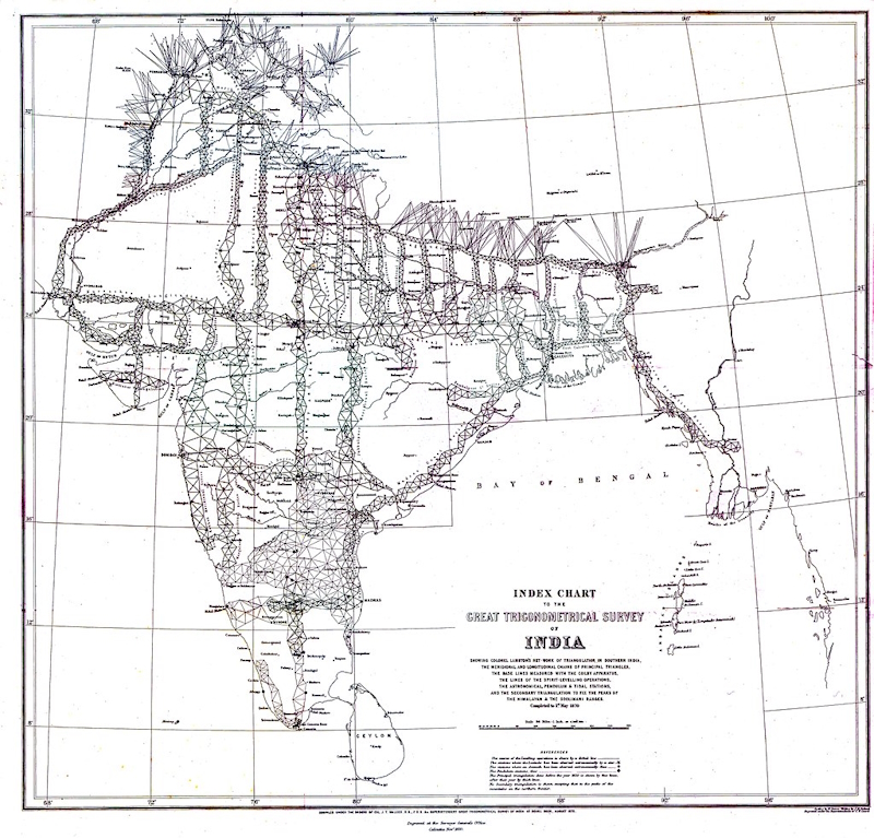 Index chart to the Great Trigonometrical Survey of India, 1870 (public domain via Wikimedia Commons)
Abdul Hamid, the first ‘pundit’, travelled to Yarkand in 1863, but aroused the suspicions of the Chinese authorities and had to return the following spring, sadly dying a short distance from a surveying station. His notes and instruments were recovered and sent to Montgomerie, and from Hamid’s work it was determined that the latitude of Yarkand was 38° 19’ N, longitude 77° 30’ E, and elevation 4000 feet above sea level. Montgomerie’s paper ‘On the Geographical Position of Yarkund and Other Places in Central Asia’ for the Royal Geographical Society was based on Hamid’s invaluable work.
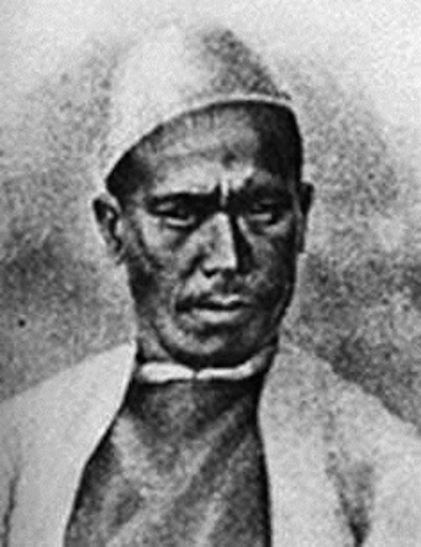
Nain Singh (public domain via Wikimedia Commons)
The success of Hamid’s expedition led to the exploration of Central Asia by other ‘pundits’, including Nain Singh, who departed for his first expedition to Lhasa in 1865. By measuring the boiling point of water, Singh concluded that Lhasa was at an altitude of 3,420m. A second expedition took Singh to western Tibet to establish the position of the headwaters of the Indus and Sutlej rivers and explore the goldfields of Thok Jalong.
According to Mark Denny, Singh was awarded a gold watch and medal by the Royal Geographical Society, as well as two villages from the government of India. However, these accolades were unusual to say the least. Many Indian surveyors were underpaid and, due to the secretive nature of their work, remain unacknowledged.
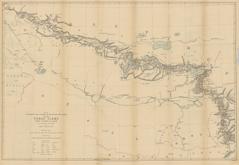 Map of Nain Singh’s exploration of Tibet (public domain via Wikimedia Commons)
It was not only explorers that were employed by the Great Trigonometrical Survey. Syed Mir Mohsin Hussain came to the notice of Colonel Valentine Blacker who, struck by Hussain’s ‘uncommon intelligence and acuteness’, appointed him to repair instruments. Hussain’s skill and ability prompted Everest to appoint him as Mathematical Instrument Maker in 1842, succeeding Henry Barrow. Everest’s confidence in Hussain is evident in his description: ‘he has both genius and originality, his conduct is marked by the highest probity, and he is one of the few on whose word I could place entire reliance.’ This did not spare him from unfair treatment: on Hussain’s appointment Everest had recommended a salary of 350 rupees per month, but the government reduced this to 250 rupees.
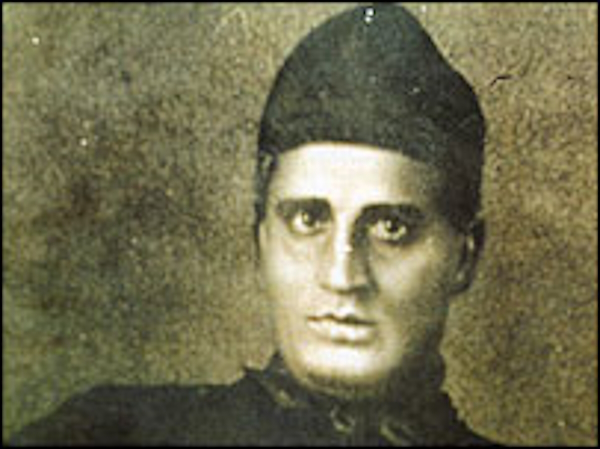
Radhanath Sikdar, an Indian mathematician born in Calcutta (now Kolkata), was another member of the Survey who was relied upon by Everest. Sikdar worked directly under Everest carrying out geodetic surveys, and was described by the latter as ‘a hardy, energetic young man’ whose habits ‘have made him hale, active, energetic, and enterprising’. Under Waugh, Sikdar was promoted to Chief Computer in 1851, and it was Sikdar's calculations which established Mount Everest (then known as Peak XV) as the highest mountain in the world.
Radhanath Sikdar (public domain via Wikimedia Commons)
The Great Trigonometrical Survey of India took 70 years to complete. There are countless Indian personnel named in volumes of the Historical Records of the Survey of India who made significant contributions to the mapping of India. Some lost their lives while on expeditions to dangerous and remote locations, and many were often unfairly treated. Though less well preserved in the archival record, their contributions are no less important.