Frankie Chappell looks at the maps produced by explorers and whalers such as William Scoresby FRS, and compares them with the ways in which indigenous inhabitants recorded their lands.
In today’s world, we take maps for granted. If you’re about to embark on a long drive or trying to find the chippy in an unfamiliar town, your preferred map app is just a swipe and a tap away. Despite both of these being out of bounds at the moment, I’ve found myself looking at maps a lot, wistfully thinking of the places I’ll go, as well as virtually peering out of other people’s windows.
Historically, surveyors were often motivated by finding themselves vulnerable in unfamiliar territory during times of warfare or rebellion. The Ordnance Survey originates from the need to map the Scottish Highlands during the 1745 Jacobite rebellion, for example. But maps were also required for recording trade routes and assessing controlled lands and resources, and so were a key tool for imperial powers. For this purpose, accuracy was of the utmost importance, but that doesn’t mean that they were necessarily devoid of rhetoric. Maps as sources can tell us just as much about the mapmaker as about the lands they purport to represent – perhaps more.
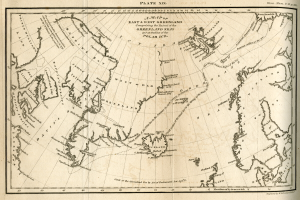
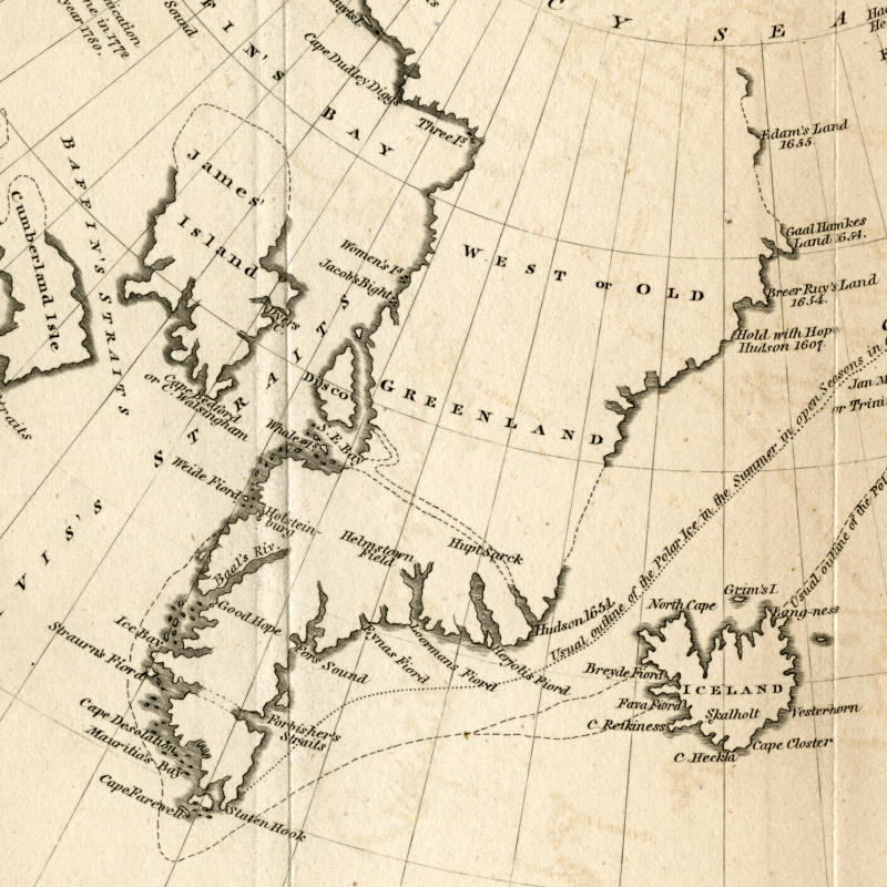
Looking through our Picture Library, I came across the above map of Greenland. It comes from an article by William Scoresby FRS, in which he explains the character of ice formations in the area. Scoresby was nothing if not thorough, but reading through all 80-odd pages it becomes obvious that he’s not just describing these various frozen formations for the pure love of ice, despite his characterization of it as the most exciting of the ‘inanimate productions’ (although, to be fair, hundreds of miles of ‘Floating Mountains’ do sound exciting). Rather, he writes about some of the most perilous aspects of the landscape, which would have been important considerations for explorers and whalers alike to survive their journeys.
Scoresby in fact notes at the end his thoughts on the possibility of reaching the North Pole, showing the drive for further ‘discovery’. The initial driver of the voyages of Scoresby and his father (William Scoresby Senior) to the region was whaling, from which they made their fortunes. The northern whaling industry grew throughout the nineteenth century, as whale oil was a sought-after lubricant for the expansion of industry, a light-source and much more besides. Whalers made use of local Inuit knowledge but simultaneously brought diseases and alcohol to Arctic communities, and decimated the whale population.
The place names on Scoresby’s map demonstrate the way in which the lands in Greenland and the surrounding areas were designated as newly discovered, despite having been long inhabited and intimately well-known. ‘Baffin’s Bay’, named after navigator William Baffin, denotes the area of Avannaata Imaa (Greenlandic) or Saknirutiak Imanga (Inuktitut).
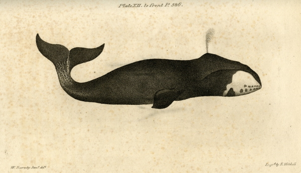
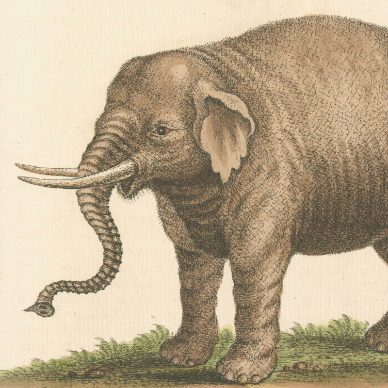
Bowhead whale, from an article by William Scoresby FRS in Memoirs of the Wernerian Society, volume 1 (1808-1810), plate 12 (RS.12352)
Of course, maps were not the invention of colonial and imperial explorers or solely used by Western traders. Recording the land, sea or sky for reference has been practised by societies across the world and throughout history. The Inuit people of Kalaallit Nunaat (Greenland) in the nineteenth century produced maps in a very different way. Ammassalik wooden maps were carved from driftwood and small in size, meaning they were easily portable, would float if dropped overboard and could be read in the dark due to their tactile nature.
Ammassalik wooden maps (Wikimedia Commons)
In the late nineteenth century, Danish naval officer Gustav Holm bought maps of the east coast of Kalaallit Nunaat from a man named Kunit. It’s admittedly disputed whether these represent common practice, and Hans Harmsen of the Greenland National Museum has said that they were more likely used for storytelling. However, navigating and storytelling were not necessarily so distinct. Michael Engelhard states that for Inuit peoples, stories were attached to landmarks to help travelers remember the way.
The Ammassalik maps are an interesting contrast with the one used in Scoresby’s article, and show how the purpose of a map can drastically change its presentation and content. Areas which were unnavigable by European powers, and not represented in Western-style maps, were deemed ‘uncharted’ only because they were not charted in a way which was legible or usable by those desiring to profit from them.
As we saw in a previous blogpost, when foreign explorers entered what were, to them, new landscapes, the knowledge of indigenous peoples contributed to their surveys of the local nature and environment. But rather than being objective records, maps produced from these voyages represented how the explorers and naturalists conceived of the lands they charted, and as such they took a different shape from the way in which the indigenous inhabitants recorded the land.
The story of Kunit is a rare and encouraging example of recognition of such knowledge, but there are surely many more. PhD research at Royal Holloway and the Royal Geographical Society has started to investigate the use and interpretation of indigenous maps by Europeans in the nineteenth century, and projects like the Decolonial Atlas have also interrogated how we’ve mapped the world.
In the Royal Society collections, there are maps and other materials from explorers aplenty. We often see the narratives of naturalists braving extreme conditions to boldly go where no man had gone before; but more research into our holdings, from different perspectives, could expand and reinterpret the accounts left by explorers in the Arctic, and across the globe. We can still get from A to B of course – but perhaps contemplating the many rich and distinctive methods of journeying, along the way.
 '
'
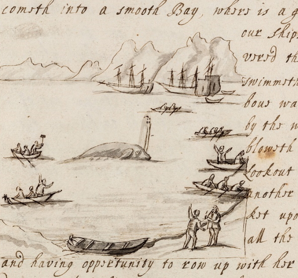
The manner of the Whale-fishing in Graenland', 1663 (RBO/2i/75)